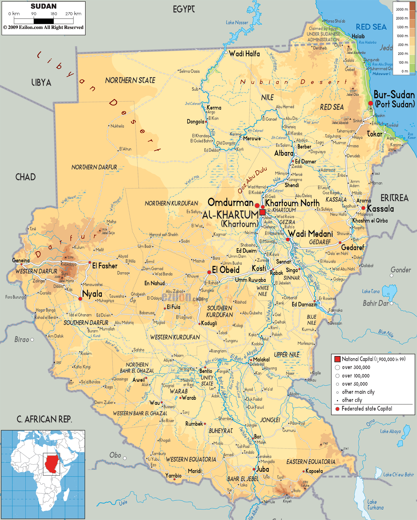

Description: The Physical Map of Sudan showing major geographical features like elevations, mountain ranges, deserts, seas, lakes, plateaus, peninsulas, rivers, plains, landforms and other topographic features.
 Sudan
is an Arab country situated in the Nile Valley of North
Africa. It is bordered by Egypt on the north, the Red
Sea, Ethiopia and Eritrea to its east. It is surrounded
by the South Sudan on the south, the Central African
Republic on its southwest, Chad and Libya on itswest and
northwest respectively. The River Nile has divided the
country into two halves.
Sudan is a part of northern Africa, with a coastline of
853 kilometres which borders the Red Sea. It covers an
area of about 1,890,000 square kilometresto become the
3rd largest country in the African continent.
Both Blue and White Nile rivers converge in the Khartoum
to form the River Nile. It then flows towards north
through Egypt and fall into the Mediterranean Sea. The
Blue Nile flows through Sudan for nearly 800 kilometres.
The Rahadand Dinder Rivers converge into the Blue Nile.
The White Nile has no significant tributaries.
Extremely dry desert areas consist of the Nubian Desert
lie in the northeast with the Bayuda Desert in the east.
There are swamps and rainforest in the south.There are
many dams on the rivers Blue and White Niles: like the
RoseiresandSennar Dams on the river Blue Nile as well as
the Jebel Aulia Dam on the White Nile.

Political Map of Sudan
Political map and map image of Sudan.

Road Map of Sudan
Road map and map image of Sudan.

Regional Directory of United States of America
Information and guide about United States of America and websites with American topics.

Regional Directory of Europe
Information and guide about Europe and websites with European topics.

Regional Directory of Australia
Information and guide about Australia and websites with Australian topics.