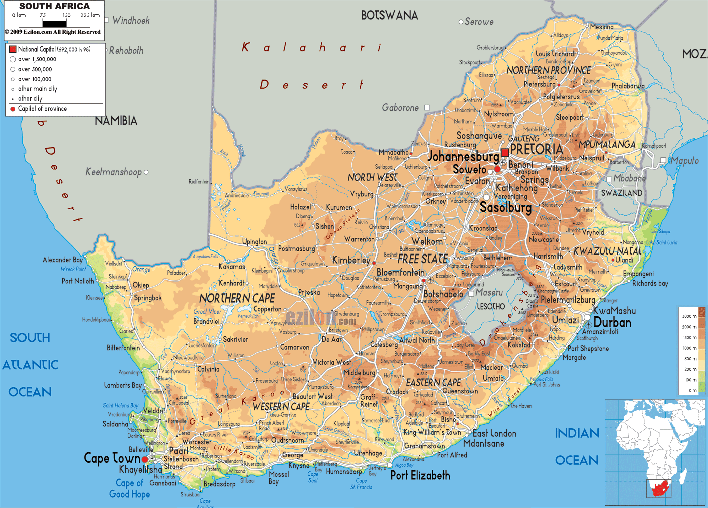

Description: The Physical Map of South Africa showing major geographical features like elevations, mountain ranges, deserts, Ocean, lakes, plateaus, peninsulas, rivers, plains, landforms and other topographic features.
 South
Africa is a country located at the southern tip of
Africa. It has a coastline of 2,798 kilometres which
borders the South Atlantic Ocean as well as the Indian
oceans. It also borders the countries of Namibia,
Zimbabwe and Botswana in the north. It has Swaziland and
Mozambique in the east.
South Africa forms the southernmost region of African
continent. It has a long coastline which stretches for
about 2,500 kilometers and borders the two oceans (the
Indian and the South Atlantic). It covers an area of
1,219,912 square kilometresand is thus the 25th largest
country in the world. Drakensberg's Mafadi standsat
3,450 meters is the highest peak of South Africa.
The Cape Fold Mountains run parallel to the country's
coast. The coastal strip bordering the Atlantic Ocean
also known as the Cape Peninsula forms the southern-most
tip of the country. It ultimately terminates at the
border with Namibia forming the Orange River.
South Africa also possesses a small sub-Antarctic
archipelago present in the Prince Edward Islands. It
consists of Marion Island as well as the Prince Edward
Island.

Political Map of South Africa
Political map and map image of South Africa.

Road Map of South Africa
Road map and map image of South Africa.

Regional Directory of United States of America
Information and guide about United States of America and websites with American topics.

Regional Directory of Europe
Information and guide about Europe and websites with European topics.

Regional Directory of Australia
Information and guide about Australia and websites with Australian topics.