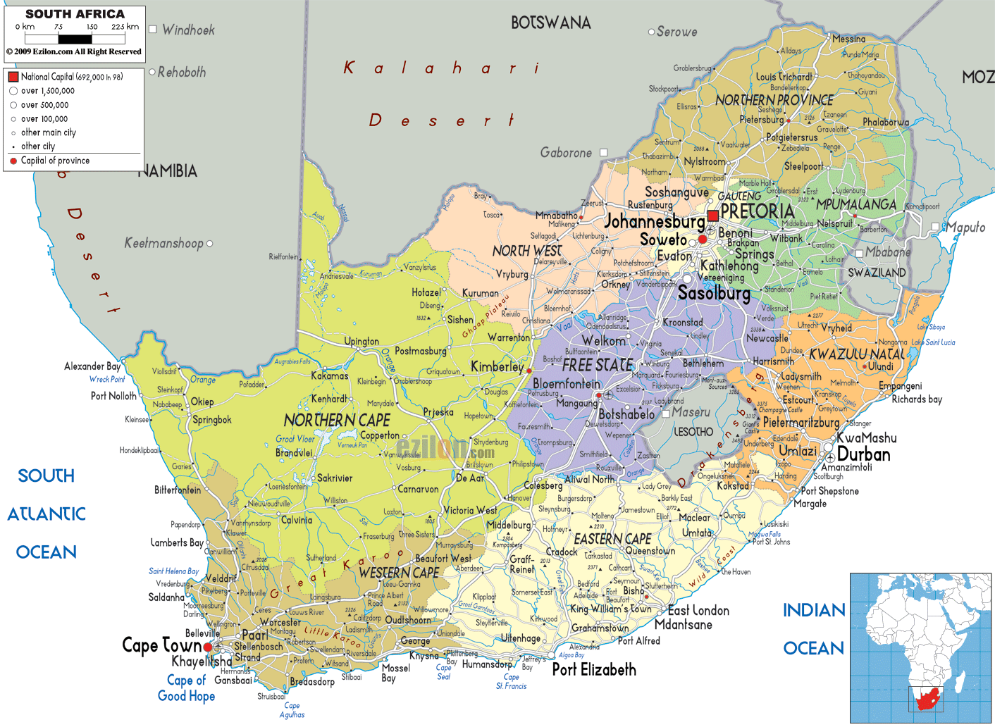

Description: Detailed large political map of South Africa showing names of capital cities, towns, states, provinces and boundaries with neighbouring countries.
 South
Africa is a nation that lies in Africa and it is
situated on the southern tip of this continent. The
coast of this country is about 2,798 kilometers in size
and it is surrounded by the Indian Ocean and the
Atlantic Ocean. The countries lying on the north of
South Africa are Zimbabwe, Namibia and Botswana; and it
has Swaziland and Mozambique on its east. The climate in
South Africa is temperate in nature because the country
is surrounded by two oceans on three sides. There are
eleven official languages in the country and English is
one if it's official language. English is also the
commonly spoken language in the country.
South
Africa is a nation that lies in Africa and it is
situated on the southern tip of this continent. The
coast of this country is about 2,798 kilometers in size
and it is surrounded by the Indian Ocean and the
Atlantic Ocean. The countries lying on the north of
South Africa are Zimbabwe, Namibia and Botswana; and it
has Swaziland and Mozambique on its east. The climate in
South Africa is temperate in nature because the country
is surrounded by two oceans on three sides. There are
eleven official languages in the country and English is
one if it's official language. English is also the
commonly spoken language in the country.
The people from South Africa are called South
Africans.

Physical Map of South Africa
Physical map and map image of South Africa.

Road Map of South Africa
Road map and map image of South Africa.

Regional Directory of United States of America
Information and guide about United States of America and websites with American topics.

Regional Directory of Europe
Information and guide about Europe and websites with European topics.

Regional Directory of Australia
Information and guide about Australia and websites with Australian topics.