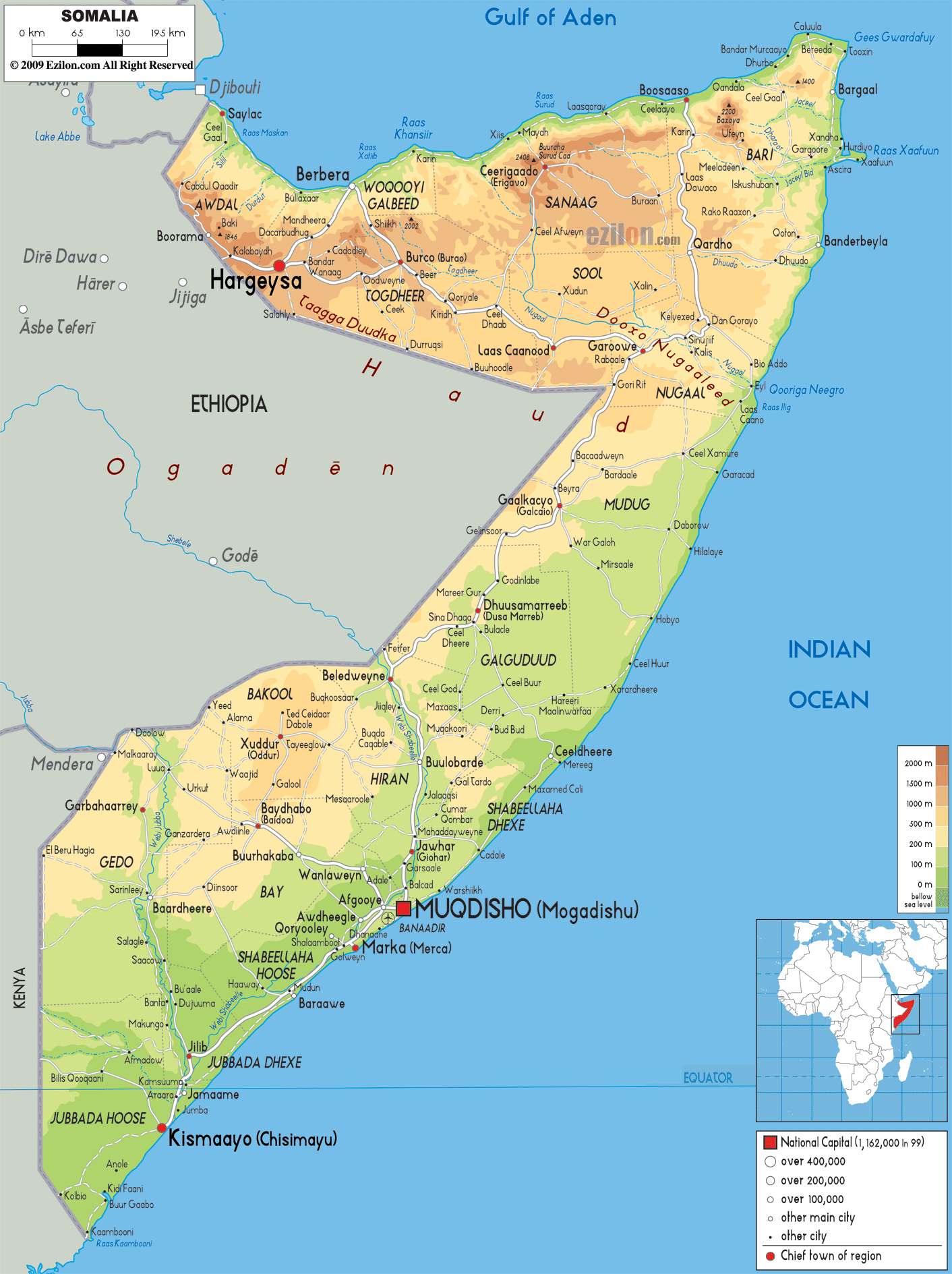

Description: The Physical Map of Somalia showing major geographical features like elevations, mountain ranges, deserts, seas, Ocean, lakes, plateaus, peninsulas, rivers, plains, landforms and other topographic features.
 Somalia,
officially known as the Federal Republic of Somaliais
located in the Horn of Africa (named after its
resemblance to a horn of rhinoceros). It is surrounded
by Ethiopia in the west, Djibouti in the northwest, the
Gulf of Aden in the north, the Indian Ocean in the east,
and Kenya in the southwest.
Somalia consists of the longest coastline on the
mainland of African continent. The country’s terrain
consists of mainly plains, plateaus and highlands.
It is located strategically in the mouth of the gateway
of Bab el Mandeb which opens into the Suez Canaland the
Red Sea.The country is located at the eastern tip of
theAfrican continent.
Somalia has many archipelagos and islands on its coast.
These include the Bajuni Islands as well as the Saad
ad-Din Archipelago. In the north there is a semi-desert
plain known as the Guban, which lies parallel to the
Gulf of Aden.
The mountain range of the Cal Madow lies in the
northeastern part. Somalia's highest peak is the
Shimbiris, which stands at a height of about 2,420
metres.

Political Map of Somalia
Political map and map image of Somalia.

Road Map of Somalia
Road map and map image of Somalia.

Regional Directory of United States of America
Information and guide about United States of America and websites with American topics.

Regional Directory of Europe
Information and guide about Europe and websites with European topics.

Regional Directory of Australia
Information and guide about Australia and websites with Australian topics.