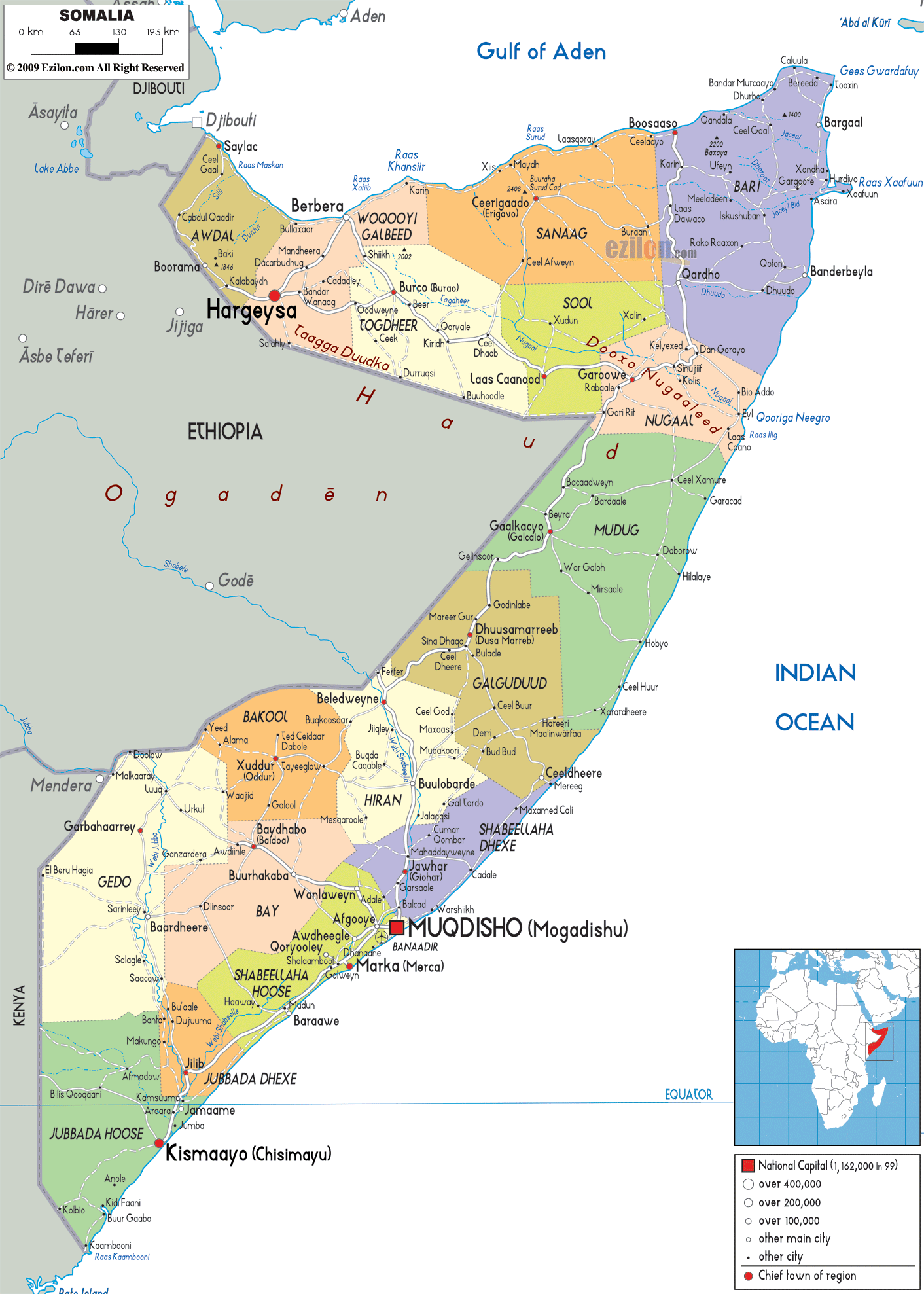

Description: Detailed large political map of Somalia showing names of capital cities, towns, states, provinces and boundaries with neighbouring countries.
 Somalia
used to be known as the Somali Democratic Republic. This
nation lies in Africa and on the west of Somalia there
is Ethiopia, on its east there is the Indian Ocean, on
its north there is the Gulf of Aden and Yemen, on its
southwest there is Kenya and on its northwest there is
Djibouti. Somalia is considered to be the easternmost
nation in Africa and it is situated in the horn of this
continent. The coastline of this country is the longest
in Africa. Somalia experiences uneven rainfall, seasonal
monsoon winds and a hot climate all through the year.
The people from Somalia are called Somalis.

Physical Map of Somalia
Physical map and map image of Somalia.

Road Map of Somalia
Road map and map image of Somalia.

Regional Directory of United States of America
Information and guide about United States of America and websites with American topics.

Regional Directory of Europe
Information and guide about Europe and websites with European topics.

Regional Directory of Australia
Information and guide about Australia and websites with Australian topics.