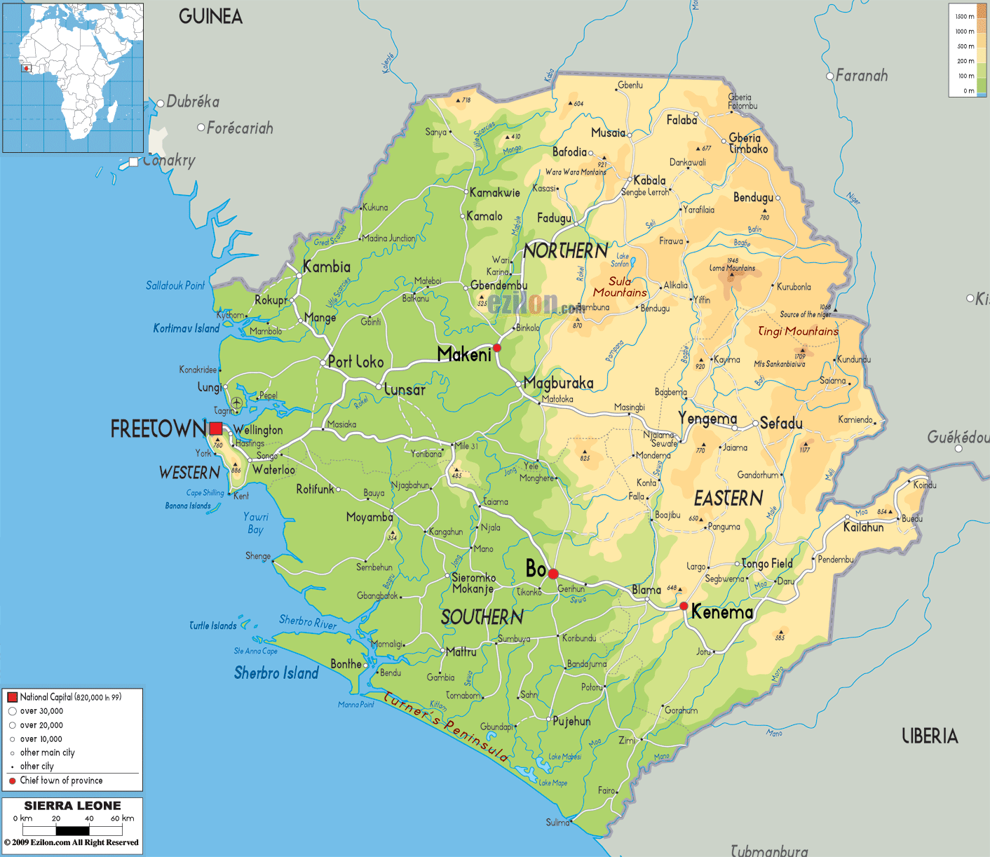

Description: The Physical Map of Sierra Leone showing major geographical features like elevations, mountain ranges, deserts, Ocean, lakes, plateaus, peninsulas, rivers, plains, landforms and other topographic features.
 Sierra
Leone is officially known as the Republic of Sierra
Leone. It is a country located in West Africa. It is
surrounded by Guinea in the northeast, Liberia in the
southeast, and the Atlantic Ocean in the southwest.
Sierra Leone covers an area of 71,740 square kilometres.
Sierra
Leone is officially known as the Republic of Sierra
Leone. It is a country located in West Africa. It is
surrounded by Guinea in the northeast, Liberia in the
southeast, and the Atlantic Ocean in the southwest.
Sierra Leone covers an area of 71,740 square kilometres.
The nations is divided into four geographical regions
namely, the Northern Province, the Eastern Province, the
Southern Province as well as the Western Area.
The central part of the country consists of lowland
plains which contains forests, bushes and some farmlands
and this occupies about 40% of the total land area. The
northern section consists of the Guinean forests &
savanna mosaic ecoregion. Thesouth has rain forests
plains.
Sierra Leone has a coastline of some 400 kilometres
bordering the Atlantic Ocean. It thus gets a bountiful
of the marine resources and also proclaimed as an
attractive tourist spot. The coast also consists of some
low lying mangroves swamp. The Sierra Leone Harbour is
considered the world's 3rdlargest natural harbor.

Political Map of Sierra Leone
Political map and map image of Sierra Leone.

Road Map of Sierra Leone
Road map and map image of Sierra Leone.

Regional Directory of United States of America
Information and guide about United States of America and websites with American topics.

Regional Directory of Europe
Information and guide about Europe and websites with European topics.

Regional Directory of Australia
Information and guide about Australia and websites with Australian topics.