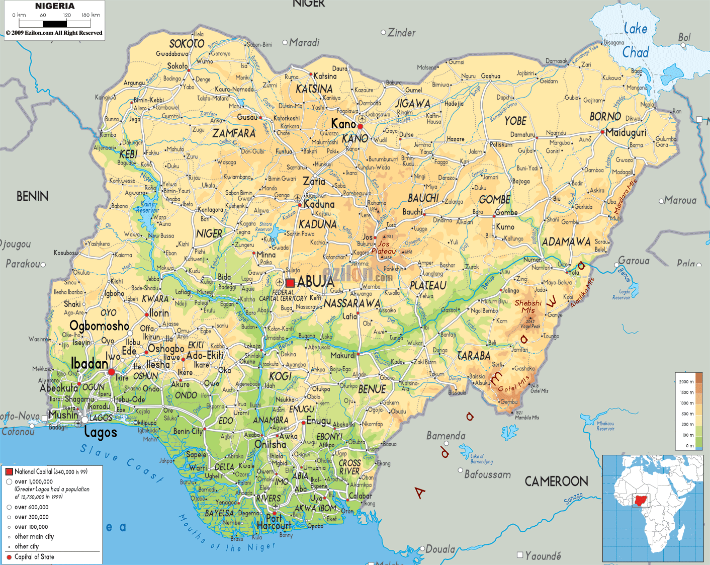
Description: The Physical Map of Nigeria showing major geographical features like elevations, mountain ranges, deserts, Ocean, lakes, plateaus, peninsulas, rivers, plains, landforms and other topographic features.
 The
Federal Republic of Nigeria, or Nigeria as it is
commonly referred to as, lies in the west of Africa and
it consists of a Federal Capital Territory and 36
states. Abuja is the capital city of this nation.
Nigeria is considered to be the 32nd largest country in
the world and its size is more or less like the size of
Venezuela. The three ethnic groups in this country,
which are considered to be the most influential and the
three largest groups, are Yoruba, Igbo and Hausa. The
Benue and the Niger are the two main rivers of Nigeria
and these rivers empty in to the largest river delta in
the world, the Niger Delta.
The
Federal Republic of Nigeria, or Nigeria as it is
commonly referred to as, lies in the west of Africa and
it consists of a Federal Capital Territory and 36
states. Abuja is the capital city of this nation.
Nigeria is considered to be the 32nd largest country in
the world and its size is more or less like the size of
Venezuela. The three ethnic groups in this country,
which are considered to be the most influential and the
three largest groups, are Yoruba, Igbo and Hausa. The
Benue and the Niger are the two main rivers of Nigeria
and these rivers empty in to the largest river delta in
the world, the Niger Delta.
The people from Nigeria are called Nigerians.

Political Map of Nigeria
Political map and map image of Nigeria.

Road Map of Nigeria
Road map and map image of Nigeria.

Regional Directory of United States of America
Information and guide about United States of America and websites with American topics.

Regional Directory of Europe
Information and guide about Europe and websites with European topics.

Regional Directory of Australia
Information and guide about Australia and websites with Australian topics.