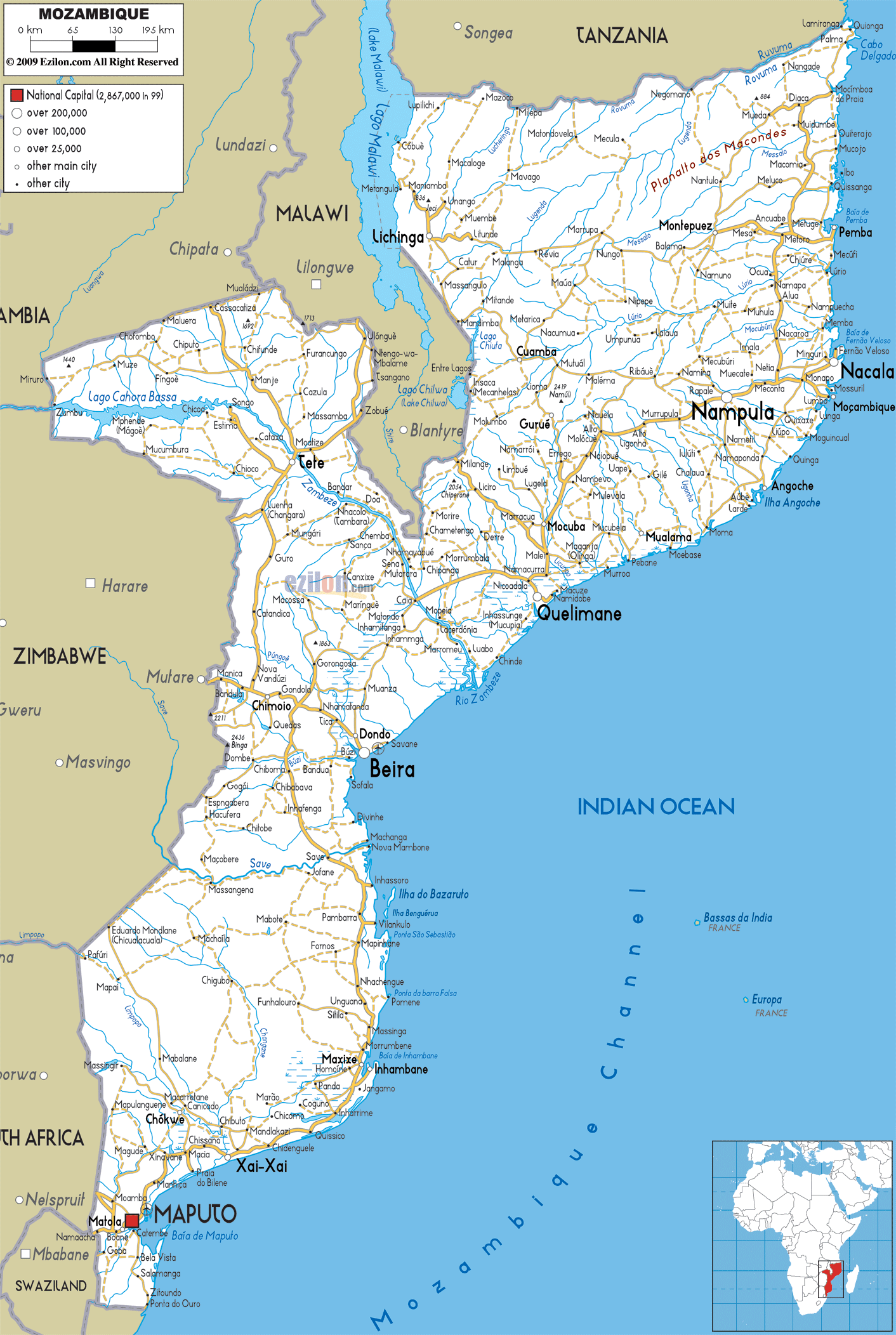

Description: Detailed clear large road map of Mozambique with road routes from cities to towns, road intersections to provinces and perfectures.
 Mozambique
is a nation that is located in the south eastern Africa.
It has Tanzania on its north, Indian Ocean on its east,
Zimbabwe on its west, Zambia and Malawi on its northwest
and South Africa and Swaziland on its southwest.
Mozambique is about double the size of California. It is
the 35th largest country on earth and its size can be
compared to the size of Turkey. There are two seasons in
Mozambique, the dry season (April to September) and the
wet season (October to March). New Metical is the
official currency of the country.
Mozambique
is a nation that is located in the south eastern Africa.
It has Tanzania on its north, Indian Ocean on its east,
Zimbabwe on its west, Zambia and Malawi on its northwest
and South Africa and Swaziland on its southwest.
Mozambique is about double the size of California. It is
the 35th largest country on earth and its size can be
compared to the size of Turkey. There are two seasons in
Mozambique, the dry season (April to September) and the
wet season (October to March). New Metical is the
official currency of the country.
The people from Mozambique are called Mozambicans.

Political Map of Mozambique
Political map and map image of Mozambique.

Road Map of Mozambique
Road map and map image of Mozambique.

Regional Directory of United States of America
Information and guide about United States of America and websites with American topics.

Regional Directory of Europe
Information and guide about Europe and websites with European topics.

Regional Directory of Australia
Information and guide about Australia and websites with Australian topics.