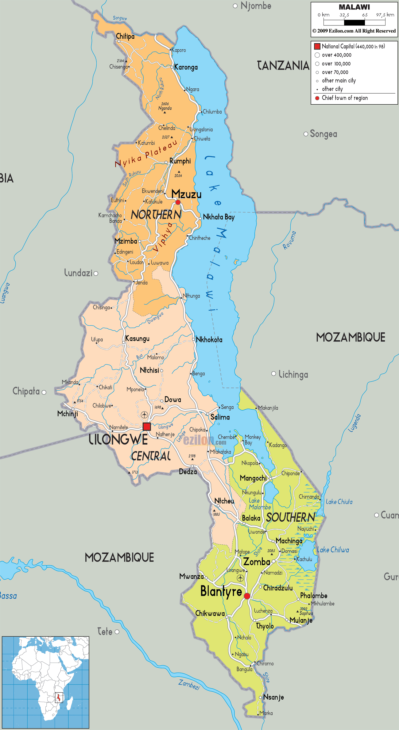
Description: Detailed large political map of Malawi showing names of capital cities, towns, states, provinces and boundaries with neighbouring countries.
 The
Republic of Malawi is a country in the Southeast Africa
and it was previously known as Nyasaland. Lake Malawi
separates this nation from Mozambique and Tanzania.
Lilongwe is the capital city of Malawi and Blantyre is
its biggest city. The population of the country is
roughly about 13,900,000. The country depends on
agriculture for its revenue and it is believed that
about half of the Gross Domestic product or GDP of
Malawi comes from agriculture alone. It also exports
products to other countries and some of the export
products are sugar, tobacco and cotton.
The
Republic of Malawi is a country in the Southeast Africa
and it was previously known as Nyasaland. Lake Malawi
separates this nation from Mozambique and Tanzania.
Lilongwe is the capital city of Malawi and Blantyre is
its biggest city. The population of the country is
roughly about 13,900,000. The country depends on
agriculture for its revenue and it is believed that
about half of the Gross Domestic product or GDP of
Malawi comes from agriculture alone. It also exports
products to other countries and some of the export
products are sugar, tobacco and cotton.
The people from Malawi are called Malawians.

Physical Map of Malawi
Physical map and map image of Malawi.

Road Map of Malawi
Road map and map image of Malawi.

Regional Directory of United States of America
Information and guide about United States of America and websites with American topics.

Regional Directory of Europe
Information and guide about Europe and websites with European topics.

Regional Directory of Australia
Information and guide about Australia and websites with Australian topics.