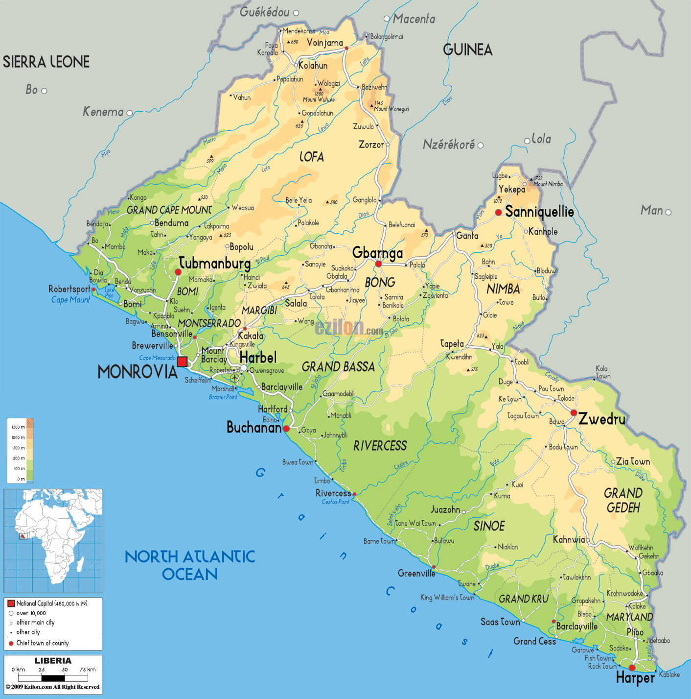

Description: The Physical Map of Liberia showing major geographical features like elevations, mountain ranges, deserts, seas, lakes, plateaus, peninsulas, rivers, plains, landforms and other topographic features.
 The
Republic of Liberia is a country located in West Africa.
It is bordered by Sierra Leone on the west, Guineato on
its north and the Ivory Coast on its east. It covers an
area of about 111,000 square kilometres. It faces the
North Atlantic Ocean on its southwestern coastline.
The country’s landscape mostly consists of flat as well
as plain coastal areas laid with swamps and mangroves.
These rise to a plateau surrounded by low mountains.
Tropical rainforests cover the hills, while elephant
grass and semi-deciduous forests make up the dominant
vegetation in the northern sections.
The highest point wholly within Liberia is Mount Wuteve
at 1,440 metres (4,724 ft) above sea level in the
northwestern Liberia range of the West Africa Mountains
and the Guinea Highlands.[35] However, Mount Nimba near
Yekepa, is higher at 1,752 metres (5,748 ft) above sea
level but is not wholly within Liberia as Nimba shares a
border with Guinea and Côte d'Ivoire (Ivory Coast) and
is their tallest mountain as well. 36 square kilometres
(43,000 sq mi) and is home to about 4 million people.

Political Map of Liberia
Political map and map image of Liberia.

Road Map of Liberia
Road map and map image of Liberia.

Regional Directory of United States of America
Information and guide about United States of America and websites with American topics.

Regional Directory of Europe
Information and guide about Europe and websites with European topics.

Regional Directory of Australia
Information and guide about Australia and websites with Australian topics.