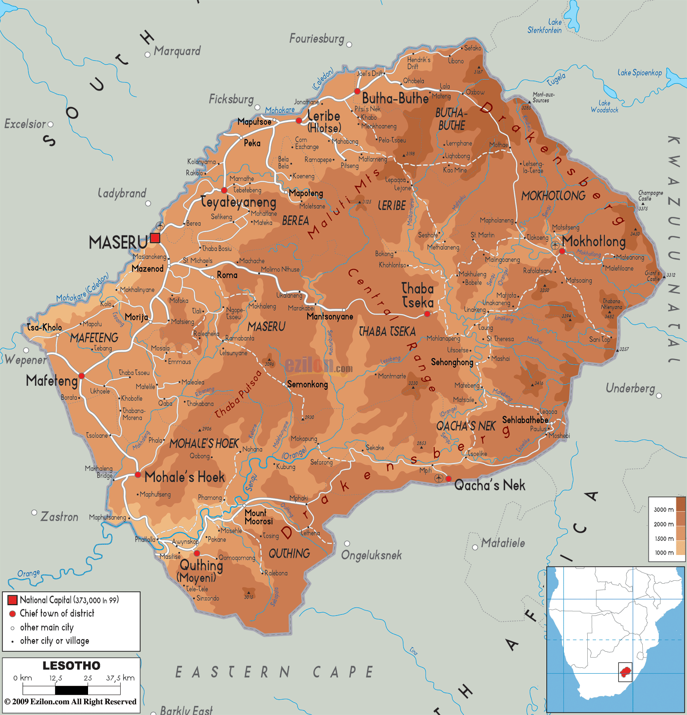

Description: The Physical Map of Lesotho showing major geographical features like elevations, mountain ranges, deserts, plateaus, peninsulas, rivers, plains, landforms and other topographic features.
 Lesotho
is the mountainous country landlocked in Southern
Africa. The country is fully surrounded by the South
African Nation. The total area taken up measures in at
30355 square kilometers all of which is land. Lesotho is
the only country in the world which completely lies
above a height of 1000 meters above sea level. It also
has the highest lowest point of any country in the world
at 1400 meters above sea level.
The highest point however rests at a height of 3482 meters above sea level and is called Thabana Ntlenyana. It is comparatively a lot cooler than the other countries which sit on the same latitudinal belt. The country lies between south latitude 29.30 degrees and east longitude 28.3 degrees.
The country can be separated into 3 distinct ecological
zones: the lowlands between the Senqu and Caledon River
valley, the highlands formed by the Maloti and
Drakensberb Mountain Ranges in the east and the
foothills in the center which divide high and low lands.
Although a negligible amount of the total area is
covered by water, there are a few important rivers in
the country.
The Orange or Senqu River is a very important one which
originates within the Drakensberg Mountains. The Caledon
River runs along the northwestern border of the country.
Some other important rivers are the Matsoku, Malibamatso
and Senqunyane rivers.

Political Map of Lesotho
Political map and map image of Lesotho.

Road Map of Lesotho
Road map and map image of Lesotho.

Regional Directory of United States of America
Information and guide about United States of America and websites with American topics.

Regional Directory of Europe
Information and guide about Europe and websites with European topics.

Regional Directory of Australia
Information and guide about Australia and websites with Australian topics.