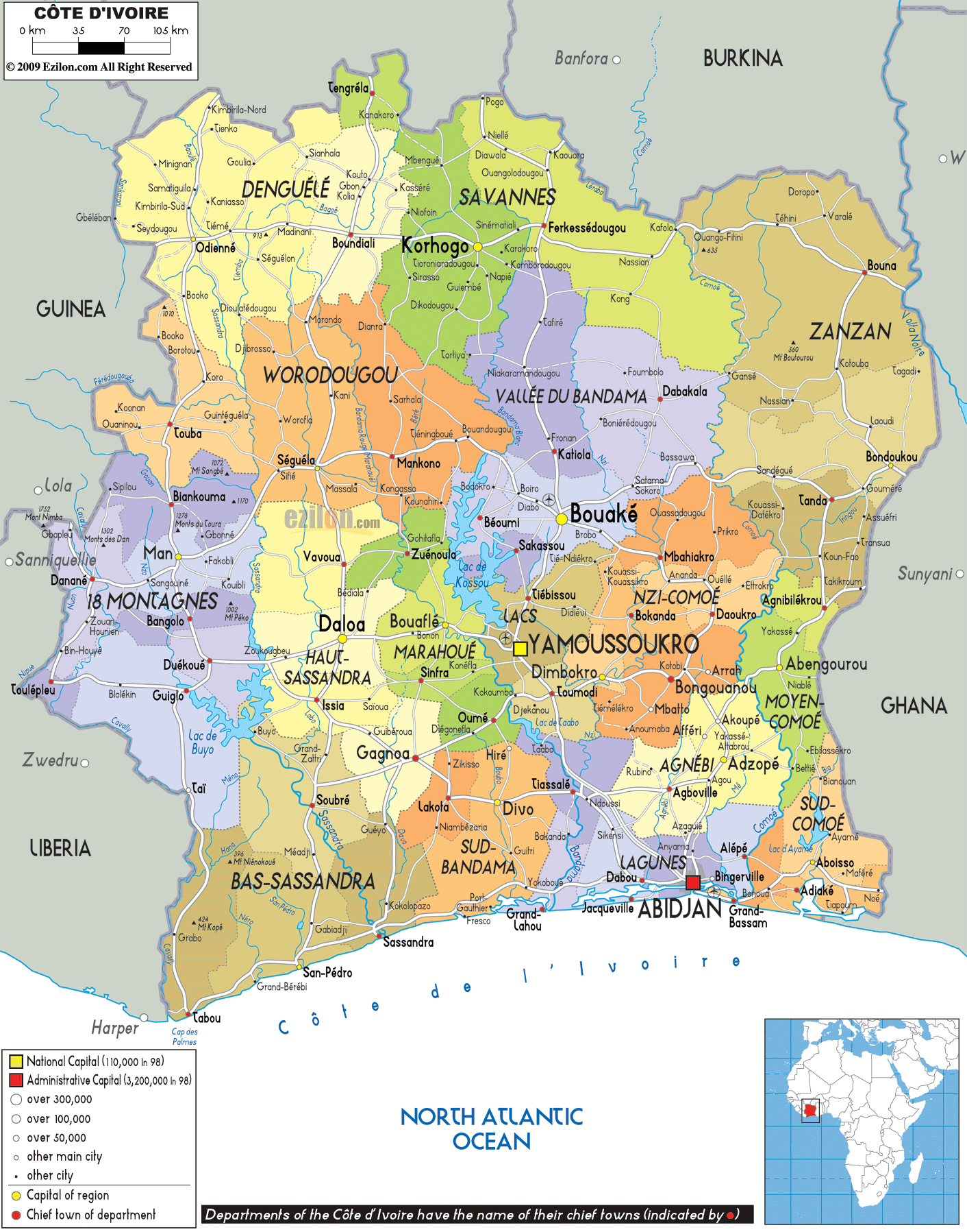

Description: Detailed large political map of Ivory Coast showing names of capital cities, towns, states, provinces and boundaries of neighbouring countries.
 The
Ivory Coast or Côte d'Ivoire is situated on the West
African coast and borders with Liberia, Mali, Guinea,
Burkina Faso and Ghana. The country also boasts a
coastline of more than 600 km facing the Gulf of Guinea
on the Atlantic Coast. Yamoussoukro is the capital and
the official language is French, while the main African
languages are Yacouba, Senoufo, Baoulé, Betie, Attie,
Agni and Dioula.
The people from Côte d'Ivoire are called
Ivorians.

Physical Map of Ivory Coast
Physical map and map image of Ivory Coast.

Road Map of Ivory Coast
Road map and map image of Ivory Coast.

Regional Directory of United States of America
Information and guide about United States of America and websites with American topics.

Regional Directory of Europe
Information and guide about Europe and websites with European topics.

Regional Directory of Australia
Information and guide about Australia and websites with Australian topics.