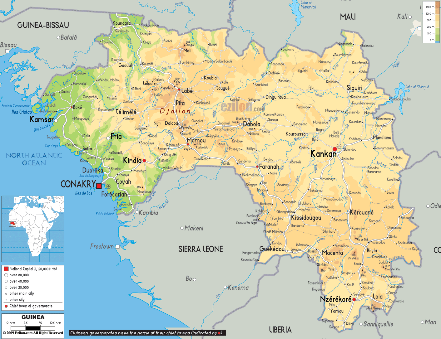

Description: The Physical Map of Guinea showing major geographical features like elevations, mountain ranges, deserts, Ocean, lakes, plateaus, peninsulas, rivers, plains, landforms and other topographic features.
 Guinea
is a country located on the west coast of Africa. The
country lies between 11 degrees north latitude and 10
degrees west longitude. The total area taken up by the
country measures in at 245857 square kilometers, all of
which is land. The country borders the North Atlantic
Ocean to the west. The country has a coastline which
extends till 320 kilometers.
The country can be divided into 4 ecological zones: the
lower guinea which sports a strip of low lying land
which runs north to south across the entire country; The
Guinea Forest; Middle Guinea Highlands and the Northern
Savanna or Upper Guinea.
The country has the origins of almost 25 African rivers
including the Gambia, Senegal and Niger. All the river
draining near Guinea empty into the North Atlantic
Ocean. The Three tributaries of the Senegal River which
flow through the nation are: Bakoy, Bafing and Faleme.
Other important rivers are the Gambia, Mongo and Lofa.
The country's highest peak is known as Mount Nimba and
it measures in at 5748 feet above sea level. The
country's terrain is mostly flat near the coasts and the
interiors are hilly and steep. The lowest point rests at
the surface of the Atlantic Ocean.

Political Map of Guinea
Political map and map image of Guinea.

Road Map of Guinea
Road map and map image of Guinea.

Regional Directory of United States of America
Information and guide about United States of America and websites with American topics.

Regional Directory of Europe
Information and guide about Europe and websites with European topics.

Regional Directory of Australia
Information and guide about Australia and websites with Australian topics.