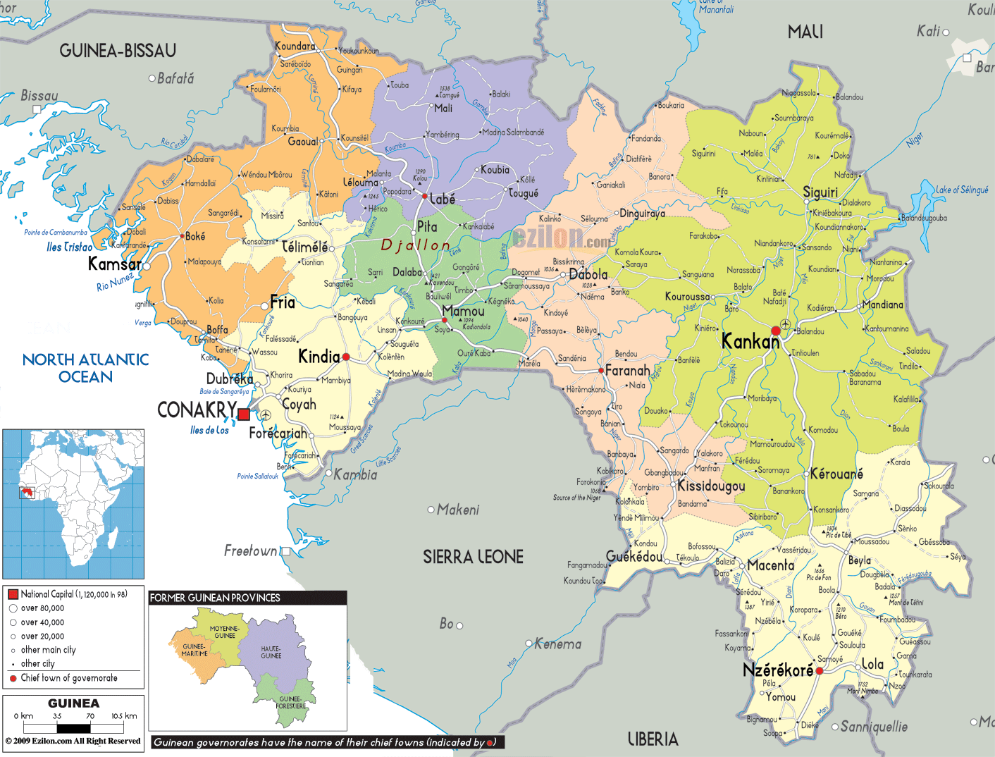

Description: Detailed large political map of Guinea showing names of capital cities, towns, states, provinces and boundaries of neighbouring countries.
 Guinea faces the Gulf of Guinea on the West Coast of
Central Africa, bordering Gabon and Cameroon. With
Malabo as the capital and Spanish and French as the
official languages, in addition to other African
dialects, Guinea also comprises the island of Bioko and
other smaller off shore islands.
Most of Guinea’s landscape offers lush vegetation and magnificent views over tropical forests and snow-capped volcanoes. The island beaches are paradise sites, with pristine white sandy beaches and clear deep blue waters.
The people from Guinea are called Guineans.

Physical Map of Guinea
Physical map and map image of Guinea.

Road Map of Guinea
Road map and map image of Guinea.

Regional Directory of United States of America
Information and guide about United States of America and websites with American topics.

Regional Directory of Europe
Information and guide about Europe and websites with European topics.

Regional Directory of Australia
Information and guide about Australia and websites with Australian topics.