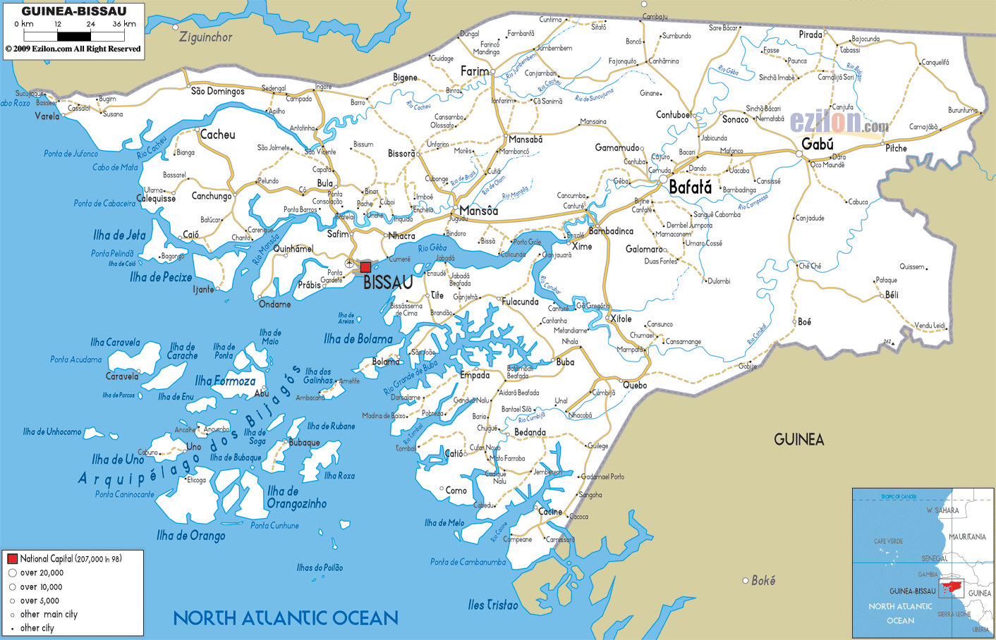

Description: Detailed clear large road map of Guinea Bissau with road routes from cities to towns, road intersections to provinces and perfectures.
 Guinea-Bissau
situated on the West Coast of Africa is a small country
bordering Senegal and the Republic of Guinea; here the
population speaks Portuguese, French, Creole and several
different local dialects. Bissau is the capital and the
country also comprises the Bijagos Islands and the
island of Bolama.
The country’s inner landscape is rich in thick forests, plateaus and mountains, while on the coast there are numerous inlets and mangrove swamps, dotted with traditional fishing villages and exceptional sandy beaches rich in wildlife.
The people from Guinea Bissau are called Guineans.

Physical Map of Guinea Bissau
Physical map and map image of Guinea Bissau.

Political Map of Guinea Bissau
Political map and map image of Guinea Bissau.

Regional Directory of United States of America
Information and guide about United States of America and websites with American topics.

Regional Directory of Europe
Information and guide about Europe and websites with European topics.

Regional Directory of Australia
Information and guide about Australia and websites with Australian topics.