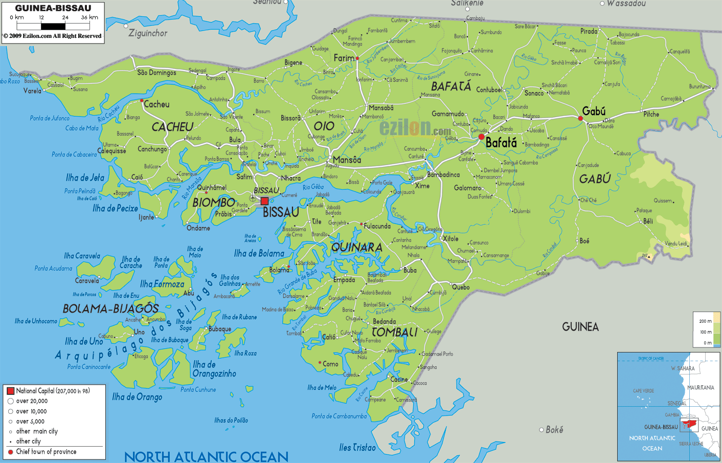

Description: The Physical Map of Guinea Bissau showing major geographical features like elevations, mountain ranges, deserts, Ocean, lakes, plateaus, peninsulas, rivers, plains, landforms and other topographic features.
 Guinea-Bissau
is a country placed in the western part of the African
continent. The country shares a coastline with the North
Atlantic Ocean which is 350 kilometers long. The
geographic coordinates of the country are 12 degrees
north latitude and 15 degrees west longitude. The total
area occupied by the country is 36120 square kilometers
of which 28000 square kilometers is land and 8120 square
kilometers is water. The country claims a territorial
which extends till 12 nautical miles from the coast.
Most of the country has a low lying area with slight
elevations to the east. The country also has many swamps
pertaining to the Guinea Mangroves. The east is occupied
by the Guinean forest and Savanna mosaic. All the rivers
in the country drain into the Atlantic Ocean. The main
rivers include the Farim, Cacheu, Canjambari and Geba.
The country is very well watered with many tributaries
of other main riversin the continent. The river basins
of other rivers are also present along the coast.

Political Map of Guinea Bissau
Political map and map image of Guinea Bissau.

Road Map of Guinea Bissau
Road map and map image of Guinea Bissau.

Regional Directory of United States of America
Information and guide about United States of America and websites with American topics.

Regional Directory of Europe
Information and guide about Europe and websites with European topics.

Regional Directory of Australia
Information and guide about Australia and websites with Australian topics.