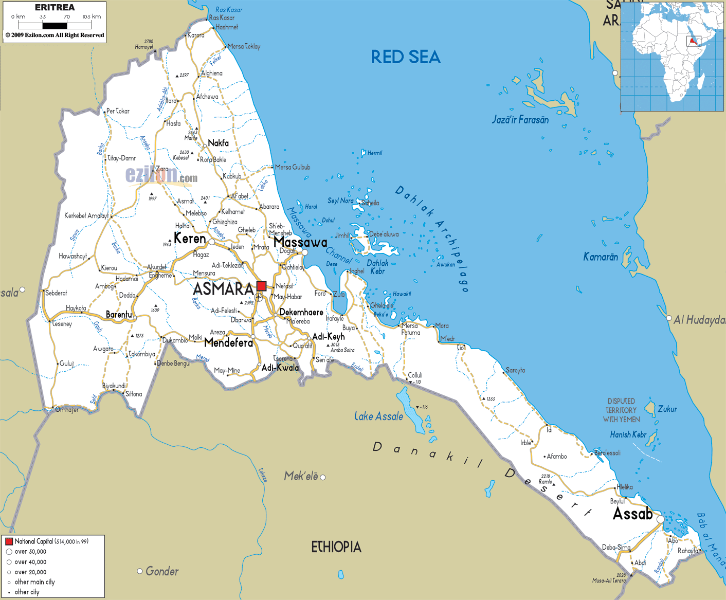
Description: Detailed clear large road map of Eritrea with road routes from cities to towns, road intersections to provinces and perfectures.
 Situated
on the Red Sea on the coast of Northeast Africa, Eritrea
borders with Djibouti, Sudan and Ethiopia. The country
stretches for nearly 1,000 km along the Red Sea, while
in the interior, mountainous landscapes prevail. The
capital Asmara boasts several mosques and churches,
notably the Al Khulafa Al Rashiundin Mosque. The
languages spoken are Tigre, Tigrinya, Arabic and
English.
Situated
on the Red Sea on the coast of Northeast Africa, Eritrea
borders with Djibouti, Sudan and Ethiopia. The country
stretches for nearly 1,000 km along the Red Sea, while
in the interior, mountainous landscapes prevail. The
capital Asmara boasts several mosques and churches,
notably the Al Khulafa Al Rashiundin Mosque. The
languages spoken are Tigre, Tigrinya, Arabic and
English.
Throughout the country there are many examples of the Turkish and Egyptian colonial periods offering several interesting architectural sites. The Italians also left their trace by greatly influencing country's cuisine.
The people from Eritrea are called Eritrean.

Physical Map of Eritrea
Physical map and map image of Eritrea.

Political Map of Eritrea
Political map and map image of Eritrea.

Regional Directory of United States of America
Information and guide about United States of America and websites with American topics.

Regional Directory of Europe
Information and guide about Europe and websites with European topics.

Regional Directory of Australia
Information and guide about Australia and websites with Australian topics.