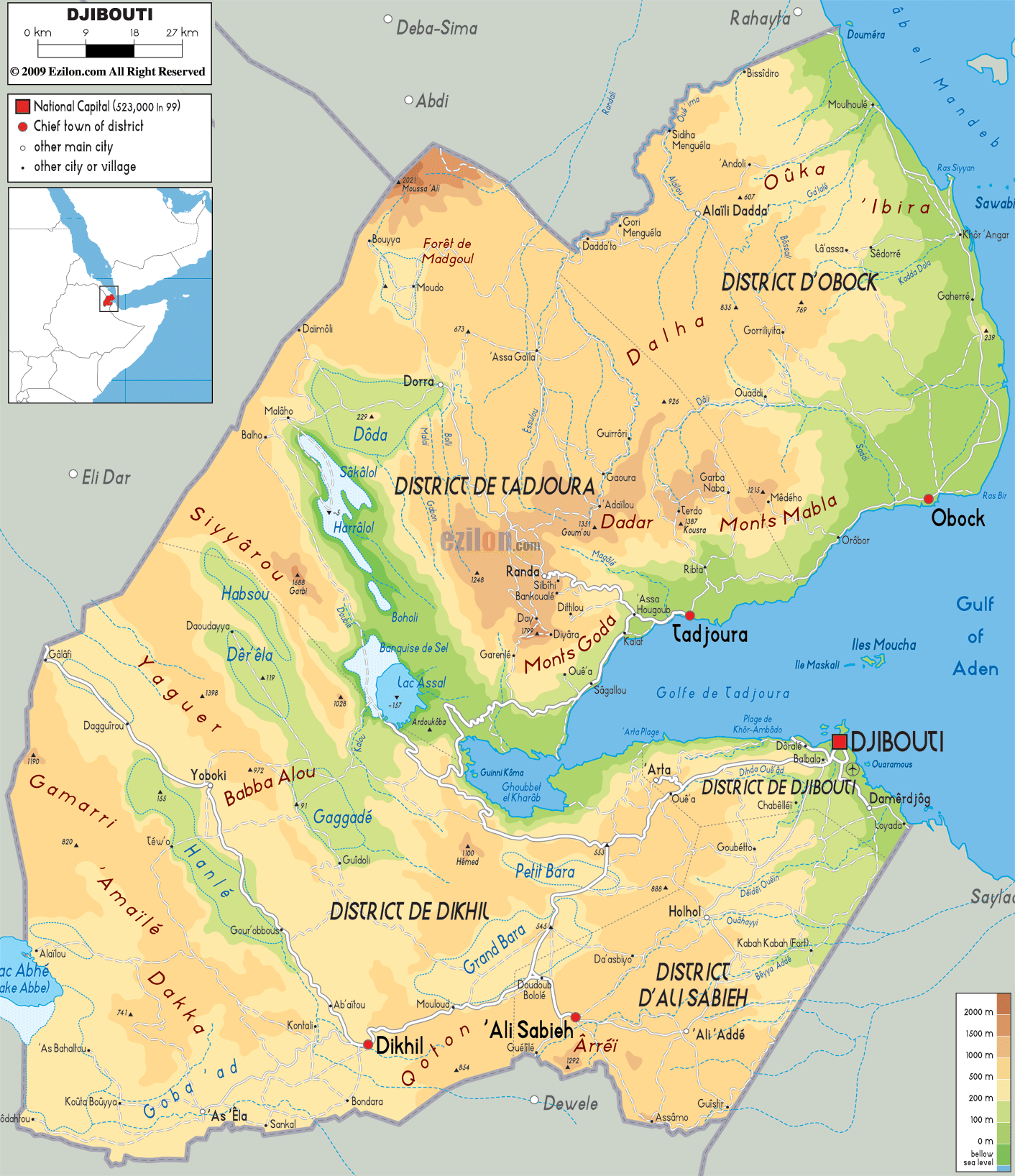

Description: The Physical Map of Djibouti showing major geographical features like elevations, mountain ranges, deserts, seas, lakes, plateaus, peninsulas, rivers, plains, landforms and other topographic features.
 Djibouti
is a country which lies at the horn of the African
country. The country has a coastline with the Gulf of
Aden and the Red Sea. 23200 square kilometers is the
total area taken up by the country out of which 23180
square kilometers is land and 20 kilometers square
contains water bodies.
Most of the country is hot and dry. The country can be
divided into 3 distinct ecological regions: The Grand
Bara, the Danakil Depression and Northern Mountains. The
Grand Bara is a desert which occupies the southern part
of the country and lies below 1700 meters above sea
level. The Depressions run across the width of the
country are covered with grasslands.
The north is densely populated with mountains and
mountain ranges. There are 8 ranges in all: Boura
Mountains, Mabla Mountains, Dagouein Mountains, Goda
Mountains, Hemed Mountain, Arrei Mountains, Gabri Range
and the Mousa Ali Range.
The Mousa Ali Range holds the highest peak at a height
of 2028 meters above sea level. The country does not
possess any permanent rivers as they only flood during
the monsoons. The Alailou, Obock and Gabone are the most
important waterways in the country. However the
Zwelenthini Kunkwenzu is the longest river in the
country.

Political Map of Djibouti
Political map and map image of Djibouti.

Road Map of Djibouti
Road map and map image of Djibouti.

Regional Directory of United States of America
Information and guide about United States of America and websites with American topics.

Regional Directory of Europe
Information and guide about Europe and websites with European topics.

Regional Directory of Australia
Information and guide about Australia and websites with Australian topics.