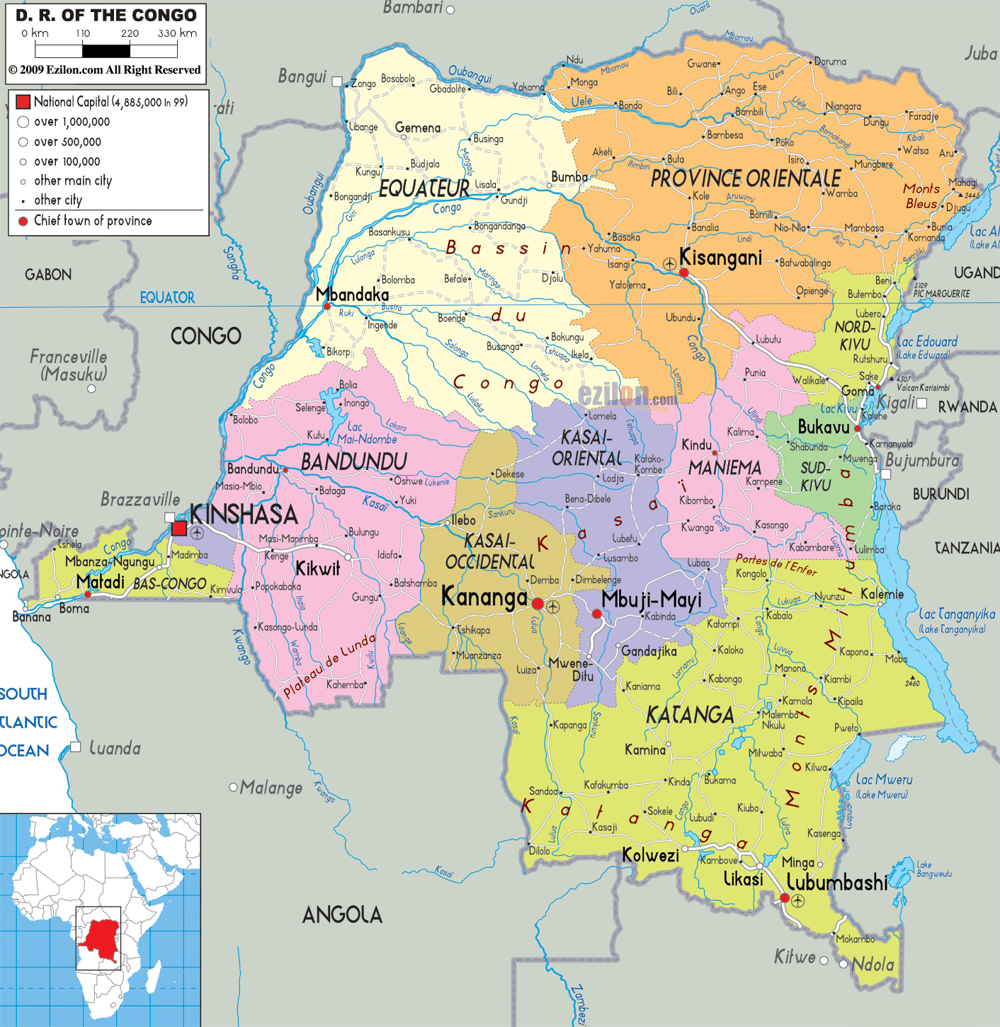

Description: Detailed large political map of Democratic Republic of Congo showing names of capital cities, towns, states, provinces and boundaries of neighboring countries.
 The
Democratic Republic of Congo is situated in Central
Africa; with Kinshasa as its capital it is the
third-largest country in Africa, bordered by Sudan, the
Central African Republic, Rwanda, Uganda, Burundi,
Tanzania, Zambia, Angola and the Republic of Congo. The
official language is French, with many local languages,
the most widely spoken being Lingala, Swahili, Tshiluba
and Kikongo.
The coastline looks over the Atlantic Ocean stretching
for a mere 27 km, which is in fact the delta of the
Congo River that flows into the Atlantic. The landcape
varies immensly with a vast central plain cut through by
the Congo River, mountain ranges, tropical rainforests,
volcanoes and lakes in the region of Kivu. These sites
offer breathtaking views over lakes and forests that
enclose waterfalls and plenty of wildlife.
The mountain peaks of the Ruwenzori Range reach up to
5119 m and offer the most spectacular views in Africa,
this is also the home of the gorillas and rare okapi.
The climate varies depending on the region. In the north
the dry season is from December to February and in the
south from April to October. It is warm and very humid
all year round.
The people of The Democratic Republic of Congo are
called Congolese.

Physical Map of Democratic Republic of Congo
Physical map and map image of Democratic Republic of Congo.

Road Map of Democratic Republic of Congo
Road map and map image of Democratic Republic of Congo.

Regional Directory of United States of America
Information and guide about United States of America and websites with American topics.

Regional Directory of Europe
Information and guide about Europe and websites with European topics.

Regional Directory of Australia
Information and guide about Australia and websites with Australian topics.