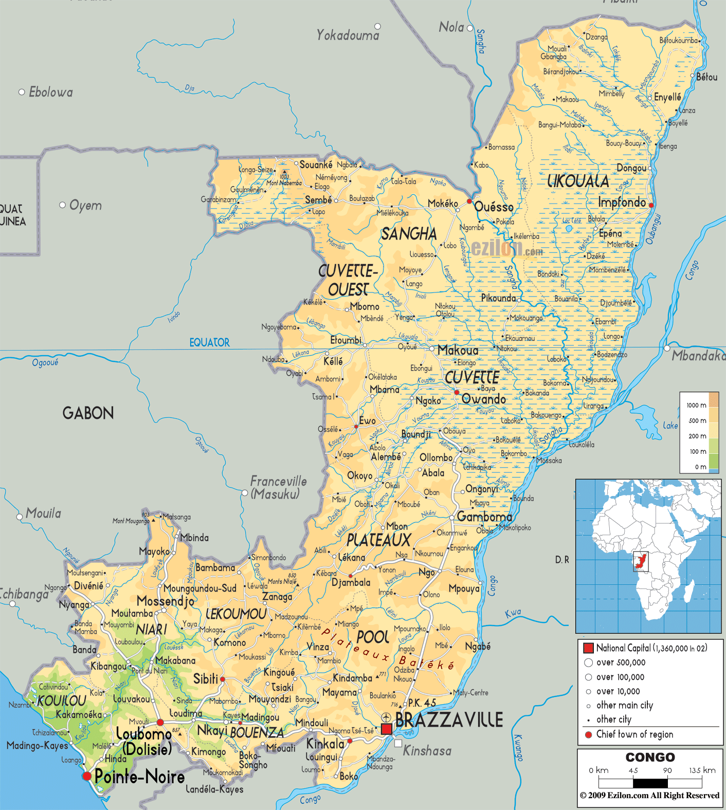
Description: The Physical Map of Congo showing major geographical features like elevations, mountain ranges, deserts, Ocean, lakes, plateaus, peninsulas, rivers, plains, landforms and other topographic features.
 The
Republic of Congo is a country situated at the heart of
the African continent. The country sits on the equator.
The country shares a 169 kilometer long coastline with
the Atlantic Ocean to the southwest. The country covers
an area of 342000 square kilometers out of which 341500
square kilometers is land and 500 square kilometers is
water. The country also claims a territorial sea up to
200 nautical miles. The country lies between south
latitude 2.8 degrees and east longitude 26.6 degrees.
The
Republic of Congo is a country situated at the heart of
the African continent. The country sits on the equator.
The country shares a 169 kilometer long coastline with
the Atlantic Ocean to the southwest. The country covers
an area of 342000 square kilometers out of which 341500
square kilometers is land and 500 square kilometers is
water. The country also claims a territorial sea up to
200 nautical miles. The country lies between south
latitude 2.8 degrees and east longitude 26.6 degrees.
The two main rivers of the country are the Congo and
Kouliou-Niari River. The Congo River is the longest
river in the country and the second largest in the
world, by means of water discharge. It is also the
deepest river in the world with depth exceeding 220
meters below sea level.

Political Map of Congo
Political map and map image of Congo.

Road Map of Congo
Road map and map image of Congo.

Regional Directory of United States of America
Information and guide about United States of America and websites with American topics.

Regional Directory of Europe
Information and guide about Europe and websites with European topics.

Regional Directory of Australia
Information and guide about Australia and websites with Australian topics.