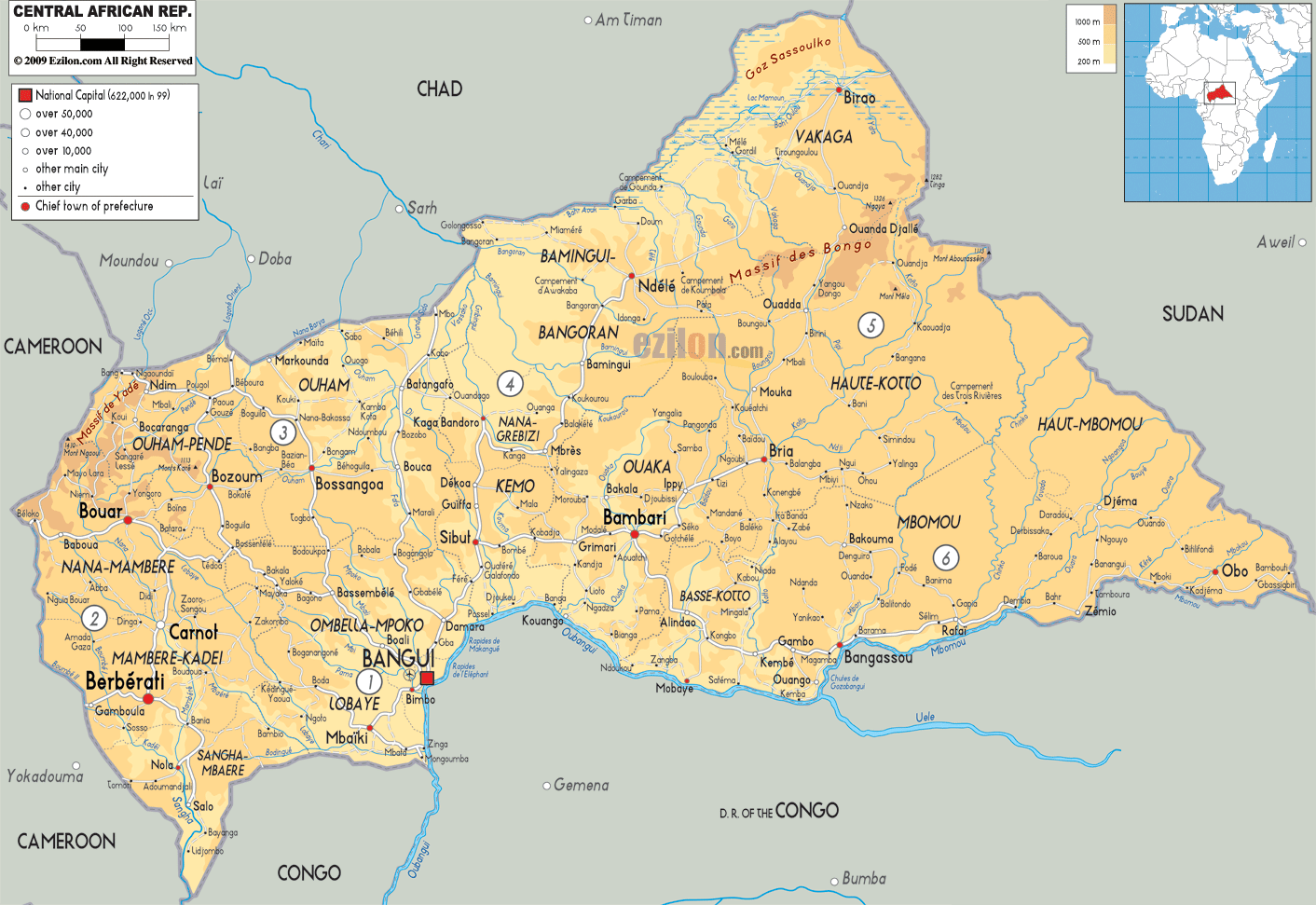

Description: The Physical Map of Central Africa showing major geographical features like elevations, mountain ranges, deserts, plateaus, peninsulas, rivers, plains, landforms and other topographic features.
 The
Republic of Central Africa is landlocked country located
deep within the African continent. The country covers an
area of 622941 square kilometres. The country lies
between 4.3 degrees north latitude and 18.5 degrees east
longitude.
The country is almost at the exact centre of the African
continent and is landlocked from all sides. Majority of
the country consists of the rolling Savannah Plateau.
The North-eastern part of the country is taken up by the
Fertit Hills. The northwest also has a massif called the
Yade which is a granite plateau. The South-western part
of the country however is dominated by undulating lands
and rolling hills.
The climate is characterized by the tropical type
with the Harmattan winds blowing in.
The southern international border is lined with the
Mbomou River which is a tributary of the mighty Congo
River. After merging with the Uele River the Ubangi
River is formed.
The western part is watered by the Sangha River and
the east is lined with the Congo-Nile watershed. About
8% of the country is covered with forests. Mount
Ngaoui is the highest natural peak sitting at 1420
metres above sea level whereas the lowest point lies
under the Oubangui River at 335 metres.

Political Map of Central Africa Republic
Political map and map image of Central Africa Republic.

Road Map of Central Africa Republic
Road map and map image of Central Africa Republic.

Regional Directory of United States of America
Information and guide about United States of America and websites with American topics.

Regional Directory of Europe
Information and guide about Europe and websites with European topics.

Regional Directory of Australia
Information and guide about Australia and websites with Australian topics.