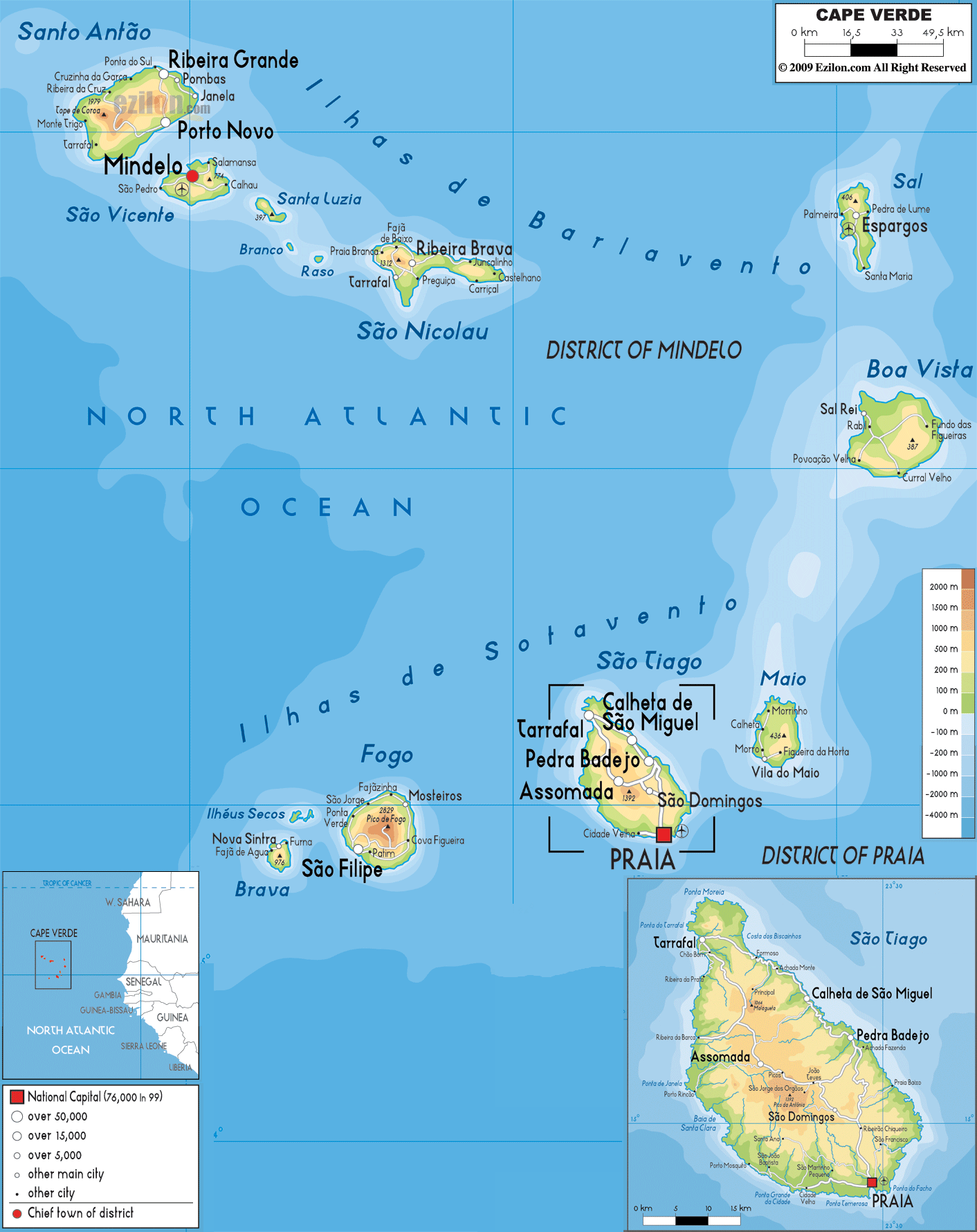

Description: The Physical Map of Cape Verde showing major geographical features like elevations, mountain ranges, deserts, Ocean, plateaus, peninsulas, rivers, plains, landforms and other topographic features.
script async src="//pagead2.googlesyndication.com/pagead/js/adsbygoogle.js">
 Cape
Verde is a group of islands which is situated in the
mid-Atlantic Ocean. The archipelago is a group of
volcanically active peaks located on almost all islands.
The islands lie between north latitude 16 degrees and
west longitude 24 degrees.
The islands are divided into two groups: The Barlavento
or windward side and the Sotavento or the leeward side.
The islands do not have any natural water sources and
are relatively flat. However some mountains on the
islands do rise to heights of 1280 metres above sea
level.
The islands cover an area of 4072.5 square kilometres.
The territorial sea belonging to the islands go up to a
distance of 12 nautical miles. The lowest point is in
the Atlantic Ocean. Cape Verde is the most arid
archipelago in the Macronesian zone.
The mountainous area has a forest known as the Laurel
forest which is very wet and full of greenery.
The country has no lakes but there are a few streams
which are essential to the life. Riberira da Garca and
RibeiraGranda are the two most important ones. Ribeira
da Janela, Ribeira do Jualo and Ribeira do Paul are the
other streams present. Overall the ecology of the
islands is very unique.

Political Map of Cape Verde
Political map and map image of Cape Verde.

Road Map of Cape Verde
Road map and map image of Cape Verde.

Regional Directory of United States of America
Information and guide about United States of America and websites with American topics.

Regional Directory of Europe
Information and guide about Europe and websites with European topics.

Regional Directory of Australia
Information and guide about Australia and websites with Australian topics.