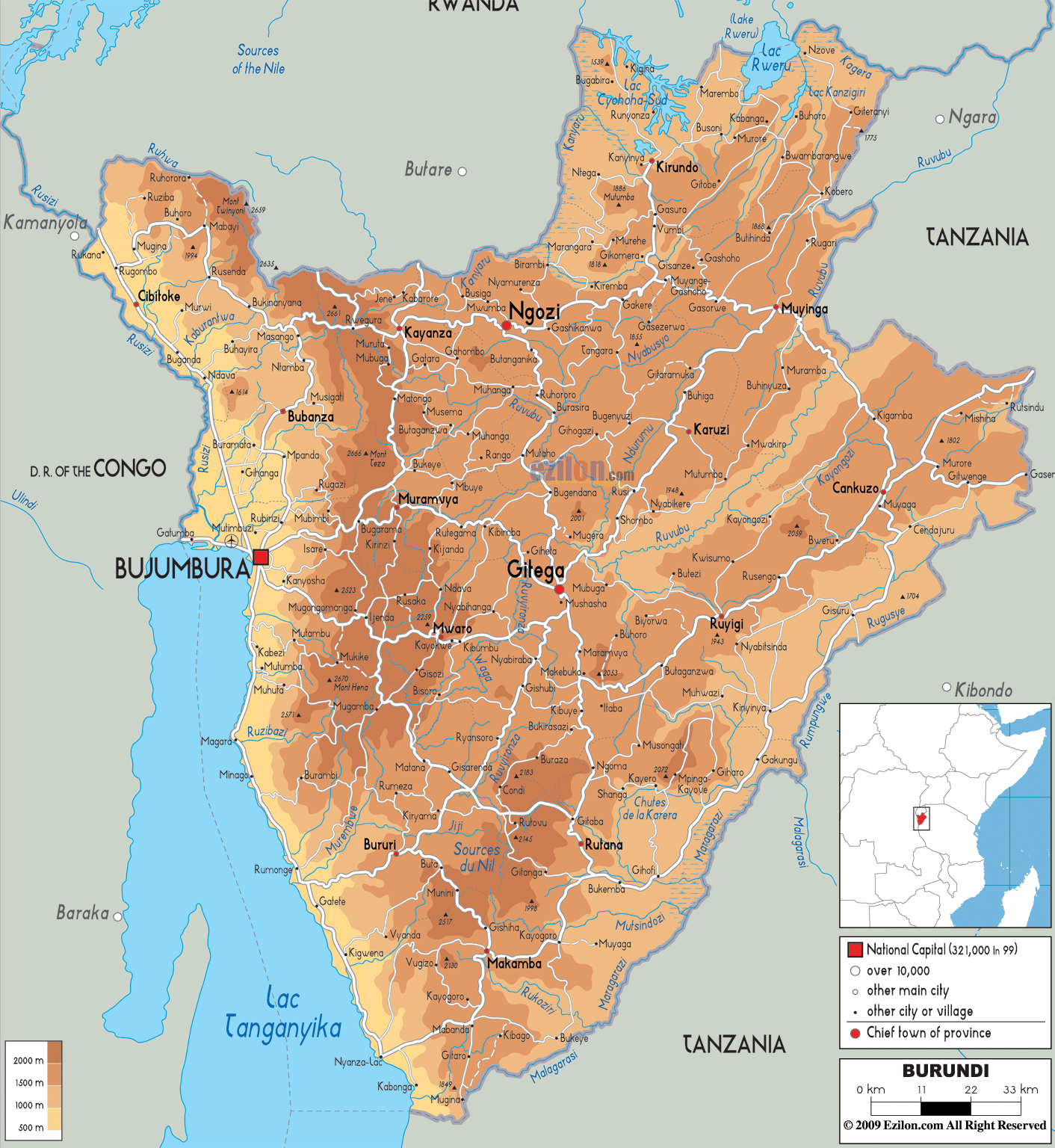

Description: The Physical Map of Burundi showing major geographical features like elevations, mountain ranges, deserts, lakes, plateaus, peninsulas, rivers, plains, landforms and other topographic features.
 Burundi
is a country situated in central Africa which falls
between south latitude 3.30 and east longitude 30
degrees. The area covered by the country amounts up to
27830 square kilometres out of which 25650 square
kilometres is covered by land. The country lies between
the Congo-Nile divide.
Most of the country’s terrain is dominated by hills and
mountains apart from the east which drops to a plateau.
The south and east ends of the country are covered by
plains. Mount Heha is the tallest natural peak,
measuring up to be 2684 metres and the lowest point lies
at Lake Tanganyika at 772 metres.
The country is landlocked and has no coastlines. Lake
Tanganyika is also the largest lake in the country. The
Nile is the longest river in the world and it originates
from its furthest tributary, Luvironza, located in
Burundi. The major rivers of the country define the
international borders. They are, Kanyaru, Kagera, Rurubu,
Ruzizi and Muragarazi.
The rivers empty into the Nile and Zaire basins. The
Nile is the longest river in the country followed by the
Ruvubu and Malagrassi Rivers. The country is very well
watered and most of the land is arable. 12.8% of the
total area covered consists of water bodies.

Political Map of Burundi
Political map and map image of Burundi.

Road Map of Burundi
Road map and map image of Burundi.

Regional Directory of United States of America
Information and guide about United States of America and websites with American topics.

Regional Directory of Europe
Information and guide about Europe and websites with European topics.

Regional Directory of Australia
Information and guide about Australia and websites with Australian topics.