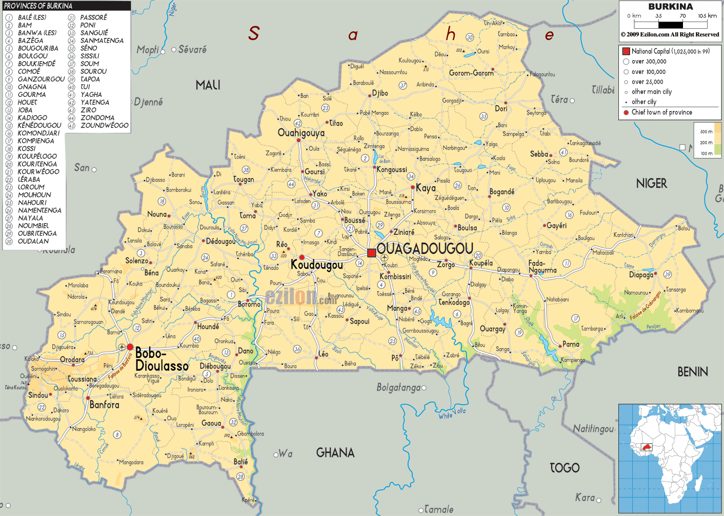

Description: The Physical Map of Burkina Faso showing major geographical features like elevations, mountain ranges, deserts, lakes, plateaus, peninsulas, rivers, plains, landforms and other topographic features.
 Burkina
Faso is a landlocked country between the Gulf of Guinea
and the Sahara Desert. The loop of the River Niger lies
just north of this small country. The country falls
between north latitudes 9 and 15 degree and longitudes 6
west and 3 east degrees. The total area covered by the
country is 274200 square kilometres out of which 273800
square kilometres comprises land.
The southern part of the country has abundant greenery
with fruit trees and forests. The northern end of the
country comprises of massive desert plains. Majority of
the country falls on the Savannah Plateau and has a few
bits of the old Precambrian Massif.
The south-western part of the country is dominated by
rocky and sandy terrain. It also has the highest natural
peak of the country which is called Tenakourou and
stands tall at 749 metres. The lowest point of the
country lies at 200 metres on the Black Volta or Mouhoun
River. The country is crossed by the three Voltas:
Black, White and Red.
The Black Volta and the Komoe are the only two rivers
which flow all year round as the others dry up during
summer. The Niger River Basin covers almost 30% of the
country’s total land area.

Political Map of Burkina Faso
Political map and map image of Burkina Faso.

Road Map of Burkina Faso
Road map and map image of Burkina Faso.

Regional Directory of United States of America
Information and guide about United States of America and websites with American topics.

Regional Directory of Europe
Information and guide about Europe and websites with European topics.

Regional Directory of Australia
Information and guide about Australia and websites with Australian topics.