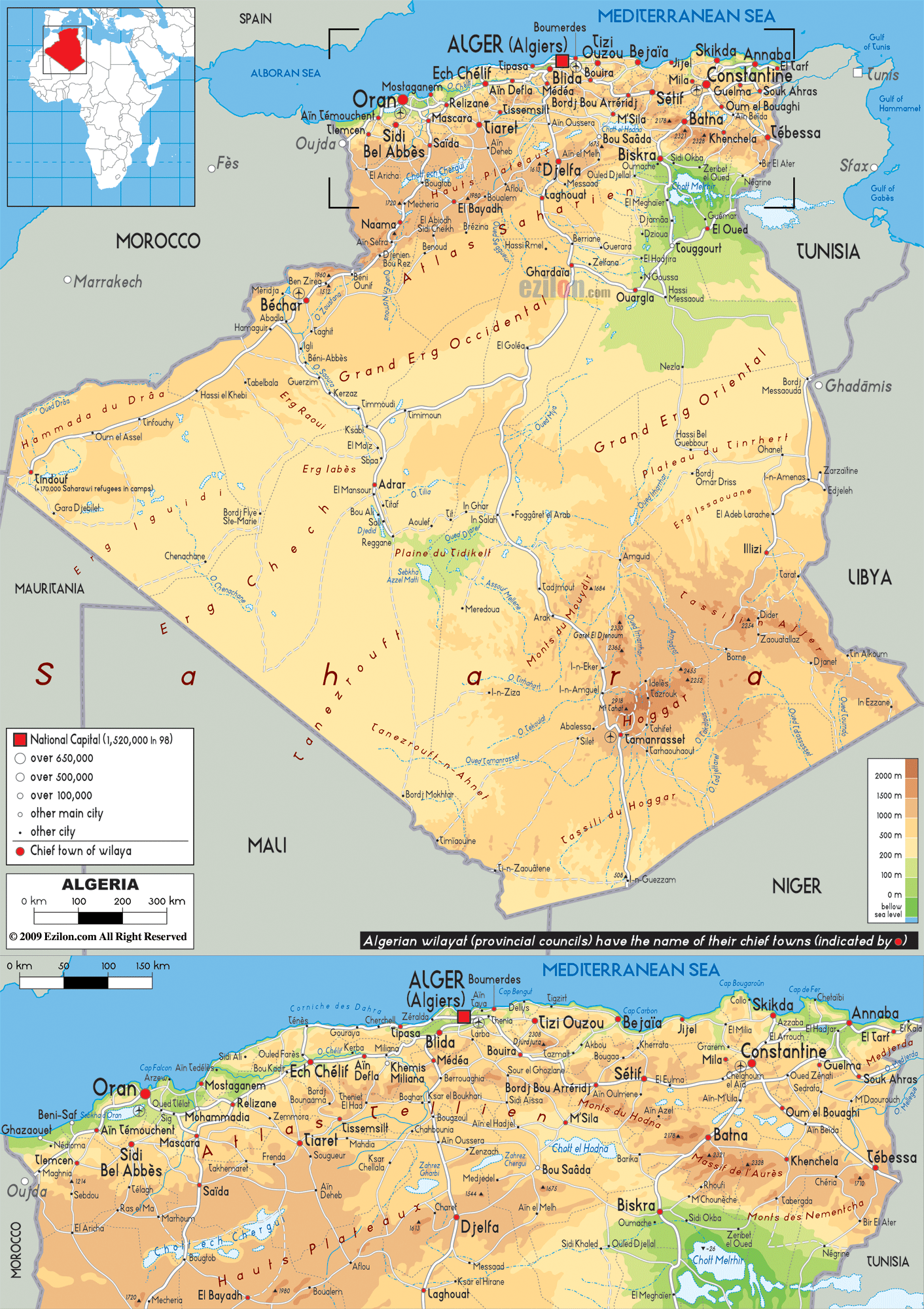

Description: The Physical Map of Algeria showing major geographical features like elevations, mountain ranges, deserts, seas, lakes, plateaus, peninsulas, rivers, plains, landforms and other topographic features.
 Algeria
is a country located in the northern part of the Africa
continent. It is a country covering 2381741 square
kilometres of which more than 80% is desert. The country
shares a coastline with the westernmost part of the
Mediterranean Sea which is called the Alboran Sea.
The coastline goes on till 998 kilometres. The north
end of the country sports mountains, plains and plateaus
while the rest of the country of covered by the Sahara
Desert. It is also called the Maghreb.
The north-western part of the country is dominated by
the Tell Atlas Mountains. Between the Tell Atlas and
Saharan Atlas Ranges lies the Hautes Plateaux.
The area rises to heights of 1400 metres at the
beginning and gradually falls to a mere 400 metres
before dying out.
The Saharan Atlas ranges are higher than the Tell
Atlases and are made up 3 major mountains known as the
Ksour Range, Ouled-Nail Range and the Amour Range.
The water supply in these high areas are provided by the
3 oases present: Laghouat, Bechar and Biskra. Eastern
Algeria is covered by the Aures Mountains. The highest
point in the country lies atop Mount Tahat, standing
tall at 3003 metres above sea level whereas the lowest
point is called Chott Melrhir and is 40 metres below sea
level.

Political Map of Algeria
Political map and map image of Algeria.

Road Map of Algeria
Road map and map image of Algeria.

Regional Directory of United States of America
Information and guide about United States of America and websites with American topics.

Regional Directory of Europe
Information and guide about Europe and websites with European topics.

Regional Directory of Australia
Information and guide about Australia and websites with Australian topics.