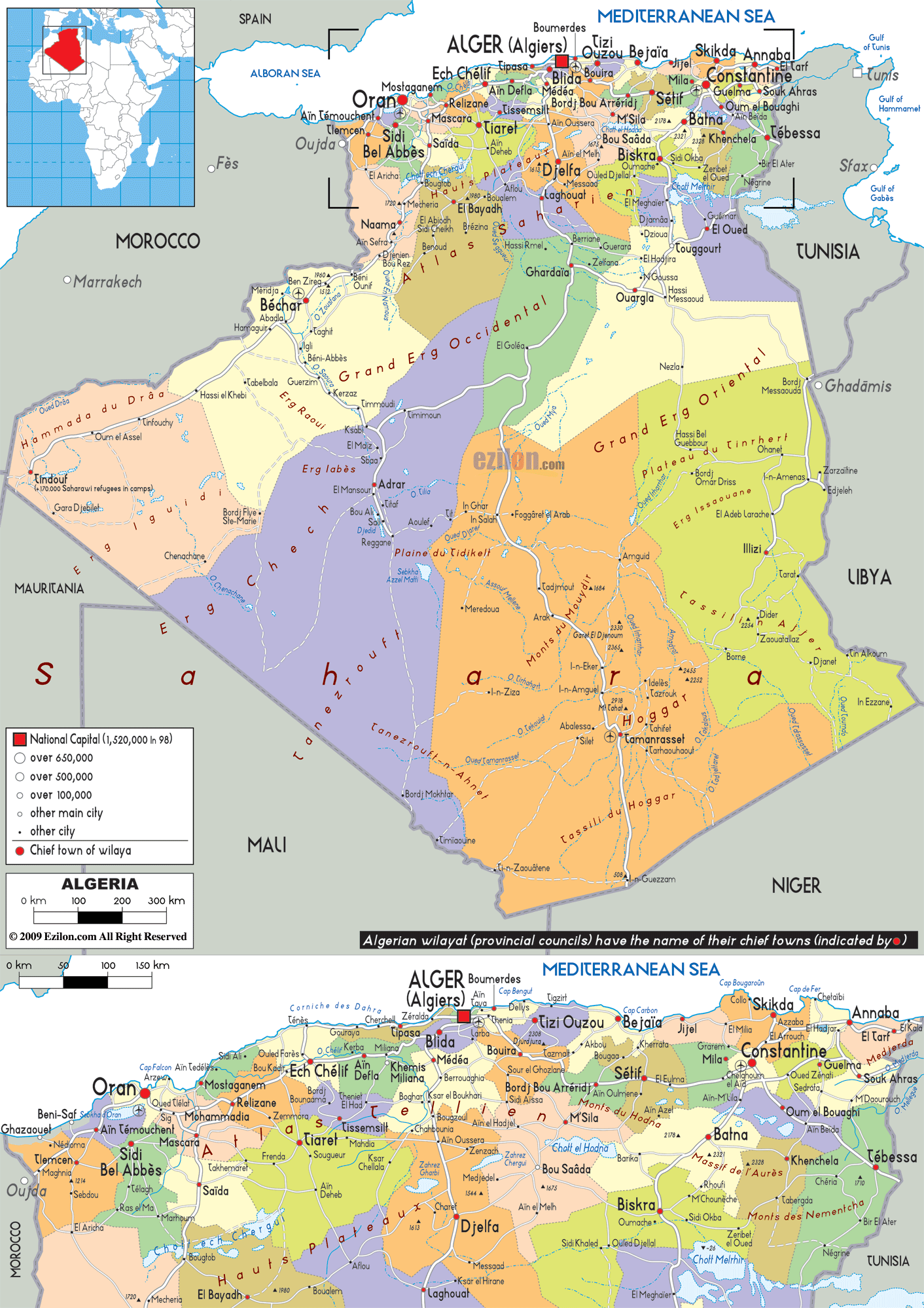

Description: Detailed large political map of Algeria showing names of capital cities, towns, states, provinces and boundaries of neighbouring countries.
 Algeria
looks out onto the Mediterranean Coast from North Africa, bordered by
Libya, Tunisia, Mali, Mauritania and Morocco and is Africa's second
largest city with more than 1,200 km of coastline. The striking Sahara
desert covers more than four-fifths of Algeria and the best way to
enter the desert is via the south, crossing the El Kautara Gorges,
which offer breathtaking views.
Algeria is connected by rail, road and air, it is
therefore easy to catch flights from the capital, Algiers to other
cities such as Ghardia, Djanet and Tamanrasset, as well as to smaller
towns. Within easy reach of Algiers are some lovely beach resorts
namely Zeralda, while to the east lies the Turquoise Coast with long
beaches and rocky inlets. There is also an excellent marina on the Sidi
Fredj penisula with plenty of sports facilities and amenities.

Physical Map of Algeria
Physical map and map image of Algeria.

Road Map of Algeria
Road map and map image of Algeria.

Regional Directory of United States of America
Information and guide about United States of America and websites with American topics.

Regional Directory of Europe
Information and guide about Europe and websites with European topics.

Regional Directory of Australia
Information and guide about Australia and websites with Australian topics.