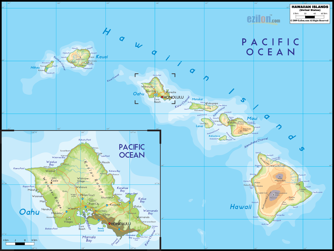

Description: The Physical map of Hawaii State USA showing major geographical features such as rivers, lakes, topography and land formations.
 Hawaii is the 8th smallest state in the country of the
United States of America. It covers an area of 28311
square kilometers. The state lies between north latitude
23 degrees and west longitude 162 degrees.
It is the only state of USA which is not connected to
the North American Continent; it is also the
southernmost state in the country. It is the world
longest chain of islands as it goes on for 1,523 miles.
The entire state is surrounded by the Pacific Ocean.
Mauna Kea is the highest point in the state as it rests
13796 feet above sea level. The lowest point of the
state however rests at the mean sea level on the Pacific
Ocean. The Anahulu and Wailuku are the major rivers of
the state. Salt Lake is the largest lake in the state.
8 inhabited islands are Nihau (smallest island), Lanai,
Kahoolawe, Kauai, Oahu, Molokai, Maui and Hawaii (the
largest island in the U.S).
The main island of Hawaii came into existence due to the
five volcanic peaks which still remain on the island.
Two of them remain active till date and are known as the
Kohala and Hualalai. The north and south coastlines are
characterized by steep rising cliffs and high waterfalls
draining into the ocean below. The state enjoys a cool
coastal climate with high levels of humidity.

Counties and Road Map of Hawaii
Counties and Road map and map image of Hawaii.

Regional Directory of Canada
Information and guide about Canada and website listing.

Regional Directory of United States of America
Information and guide about United States of America and websites with American topics.

Regional Directory of Europe
Information and guide about Europe and websites with European topics.

Regional Directory of Australia
Information and guide about Australia and websites with Australian topics.