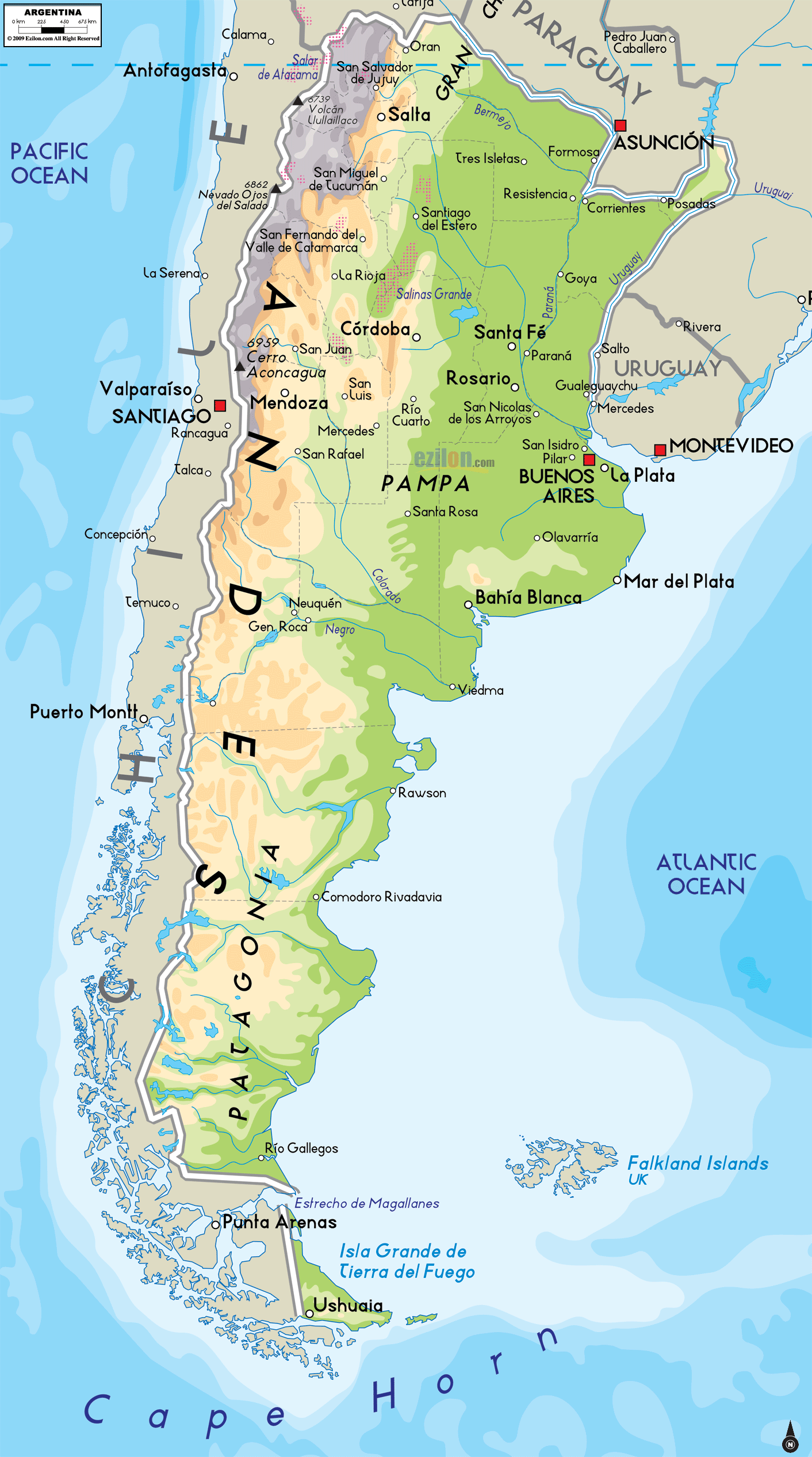

Description: The Physical Map of Argentina showing major geographical features like elevations, ocean, lakes, plateaus, peninsulas, rivers, plains, landforms and other topographic features.
 Argentina,
officially known as the Argentine Republic, is a nation
located in the south east of South America. It shares
the Southern Cone with Chile and is bordered by Paraguay
and Bolivia in the north; Brazil in the northeast. It
has Uruguay as well as the South Atlantic Ocean in the
east along with the Drake Passage in the south.
It has a mainland area of 2,800,000 square kilometres to
be proclaimed as the 8th largest nation in the world. It
is the 2ndlargest nation in the whole of Latin America.
It is located in south of the South America. It has an
overall land border length of 9,400 kilometres and has
coastal borders along the Río de la Plata and the South
Atlantic Ocean, 5,100 kilometres long.
The highest point of the country is Mount Aconcagua,
present in the province of Mendoza at 7,000metres above
the sea level. The country’s lowest point is known as
the Laguna delCarbón, located in the San Julián Great
Depression at −106metres below the sea level.
The major rivers of Argentina are the Uruguay and the
Paraná. These rivers converge and get discharged into
the Argentine Sea, forming a shallow area of the
Atlantic Ocean on the Argentine Shelf. Two major ocean
currents: the cold Falklands Current and the warm Brazil
Currentinfluence its waters.

Political Map of Argentina
Political map and map image of Argentina.

Regional Directory of South America
Information and guide about South America and website listing.

Regional Directory of United States of America
Information and guide about United States of America and websites with American topics.

Regional Directory of Europe
Information and guide about Europe and websites with European topics.

Regional Directory of Australia
Information and guide about Australia and websites with Australian topics.