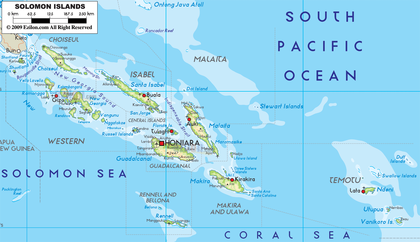

Description: The Physical Map of Solomon Islands showing major geographical features like elevations, mountain ranges, ocean, lakes, plateaus, peninsulas, rivers, plains, landforms and other topographic features.
 The
Solomon Islands is an archipelago which lies in the
South Pacific Ocean. The geographic coordinates of the
country are 8 degrees south latitude and 159 degrees
east longitude. The total area covered by the islands
adds up to 28,896 square kilometers of which 910 square
kilometers is water and 27,986 square kilometers is
land. The coastline shared by the islands is 5,313
kilometers in length.
The islands mostly contain high rocky mountains and a
few low lying coral atolls. The two main islands have
volcanoes on them and the smaller ones are covered with
palm trees and sand. The climate is mostly tropical with
distinct wet and dry seasons. The highest natural peak
on the archipelago is called Mount Popomanaseu which
measures in at 2,332 meters above sea level and the
lowest point lies at mean sea level on the Pacific
Ocean.
The islands also have a few rivers of which Waikoto is
the longest. Other major rivers include the Lunga,
Tenaru and Matanikau rivers. The fresh water makes up
for the .62% of arable land on the islands. The islands
also suffer from frequent hurricanes as they lie in the
hurricane belt of the Pacific. Volcanoes are also a
major worry sometimes.

Political Map of Solomon Islands
Political map and map image of Solomon Islands.

Regional Directory of Australia
Information and guide about Australia and website listing.

Regional Directory of United States of America
Information and guide about United States of America and websites with American topics.

Regional Directory of Europe
Information and guide about Europe and websites with European topics.

Regional Directory of Australia
Information and guide about Australia and websites with Australian topics.