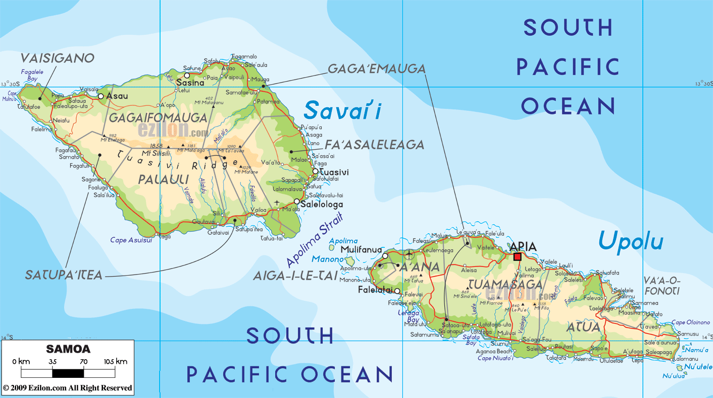

Description: The Physical Map of Samoa showing major geographical features like elevations, mountain ranges, ocean, lakes, plateaus, peninsulas, rivers, plains, landforms and other topographic features.
 The
islands of Samoa lie in the South Pacific Ocean in the
region known as Polynesia. The group consists of two
main islands and 8 smaller independent ones. The country
lies between 13.35 degrees south latitude and 172.20
degrees west longitude. The total area covered by the
islands measures in at 2,944 square kilometers of which
only 10 square kilometers is water and rest is all land.
The coastline is 403 kilometers long. The highest point
on the islands is known as Mauga Silisili and it is 1857
meters above sea level. The lowest point however rests
at mean sea level on the Pacific Ocean.
The
islands of Samoa lie in the South Pacific Ocean in the
region known as Polynesia. The group consists of two
main islands and 8 smaller independent ones. The country
lies between 13.35 degrees south latitude and 172.20
degrees west longitude. The total area covered by the
islands measures in at 2,944 square kilometers of which
only 10 square kilometers is water and rest is all land.
The coastline is 403 kilometers long. The highest point
on the islands is known as Mauga Silisili and it is 1857
meters above sea level. The lowest point however rests
at mean sea level on the Pacific Ocean.
The main islands are volcanic in nature and have narrow
coastlines with rocky peaks inland. The climate is
mostly tropical with distinct dry and wet seasons. 21%
of the entire land area is considered as arable and
suitable for crops.
The islands also have two major volcanoes known as
Savai’I and Upolu. The Savai’I volcano has erupted once
in the last century. The country has no permanent lakes
or rivers as they only flood and flow during the rainy
season. The territorial sea claim of the country reaches
12 nautical miles off shore. The islands also have many
hardwood forests.

Political Map of Samoa
Political map and map image of Samoa.

Regional Directory of Australia
Information and guide about Australia and website listing.

Regional Directory of United States of America
Information and guide about United States of America and websites with American topics.

Regional Directory of Europe
Information and guide about Europe and websites with European topics.

Regional Directory of Australia
Information and guide about Australia and websites with Australian topics.