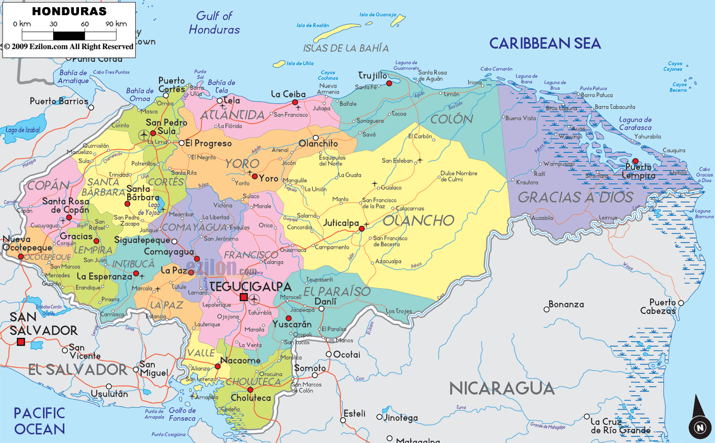
Description: Detailed large political map of Honduras showing names of capital city, towns, states, provinces and boundaries with neighbouring countries.
 Situated
in Central America Honduras shares its borders with
Nicaragua, Guatemala and El Salvador and is a country
mainly composed of lowlands with a central mountain area
which runs from the east to the west. The coast looks
out onto both the Pacific Ocean and the Caribbean Sea,
and in the Gulf of Fonseca to the southwest there are
many volcanic islands to visit.
Situated
in Central America Honduras shares its borders with
Nicaragua, Guatemala and El Salvador and is a country
mainly composed of lowlands with a central mountain area
which runs from the east to the west. The coast looks
out onto both the Pacific Ocean and the Caribbean Sea,
and in the Gulf of Fonseca to the southwest there are
many volcanic islands to visit.
Tegucigalpa is the capital and the population speaks
Spanish, English as well as several Amerindian dialects.
The temperate capital has a magnificent site, the Christ
of the Picacho set on top of a mountain, from which one
may admire the splendid views below. The historical
center is also worth visiting.

Physical Map of Honduras
Physical map and map image of Honduras.

Regional Directory of Caribbean
Information and guide about Caribbean and website listing.

Regional Directory of United States of America
Information and guide about United States of America and websites with American topics.

Regional Directory of Europe
Information and guide about Europe and websites with European topics.

Regional Directory of Australia
Information and guide about Australia and websites with Australian topics.