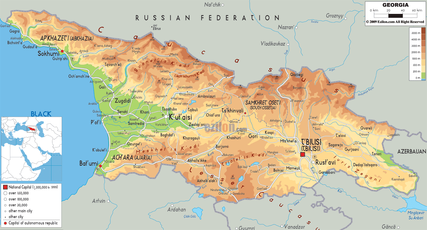

Description: The physical map of Georgia country showing major geographical features like elevations, mountain ranges, seas, lakes, plateaus, peninsulas, rivers, plains, landforms and other topographic features.
 Georgia
is a country located in Eurasia, where Western Asia
meets Eastern Europe. The region is also called the
Caucasus region owing to the mountain ranges present.
The Black Sea borders the country to the west, Russia to
the north, Turkey and Armenia to the south and
Azerbaijan to the east. The country covers an area of
approximately 69875 square kilometers.
The Georgian and Russian border is marked by the high Great Caucasus Mountains. The Lesser Caucasus Mountains run down south and are parallel to the Turkish and Armenian border. The Surami and Imereti ranges are the ranges which connect the Caucasus ranges across the country.
There are nearly 25000 rivers in the country which drain out either into the west based Black Sea or the Caspian Sea after crossing Azerbaijan through the east. The Mtkvari or Kura is the longest river in the country and goes on for 1364 kilometers. The Rioni River on the other hand is the largest river network in the country.
It originates in the Greater Caucasus Range and drains into the Black Sea. Mount Shkhara is the highest natural peak in the country and stands at a staggering 5201 meters whereas the lowest places lies near the Poti port and range from 1.5-2.3 meters below surface.

Political Map of Georgia
Political map and map image of Georgia.

Road Map of Georgia
Road map and map image of Georgia.

Regional Directory of United States of America
Information and guide about United States of America and websites with American topics.

Regional Directory of Europe
Information and guide about Europe and websites with European topics.

Regional Directory of Australia
Information and guide about Australia and websites with Australian topics.