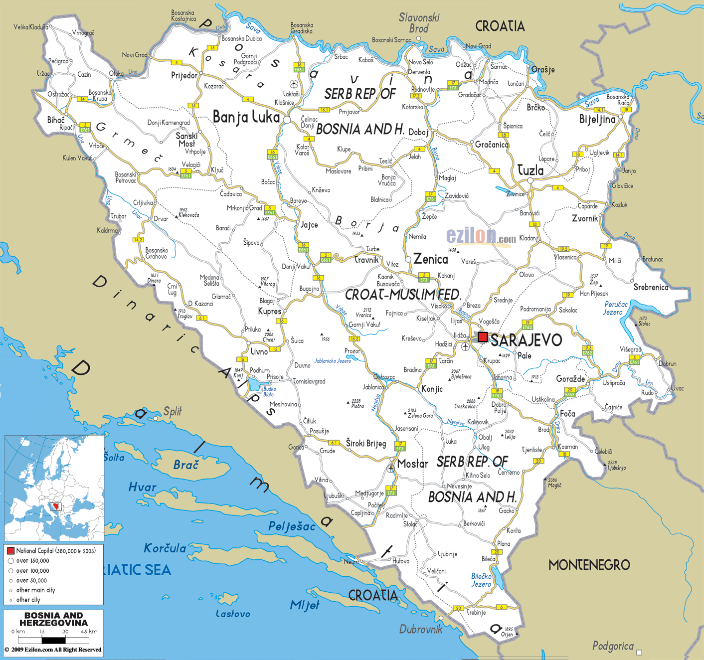

Description: Detailed clear large road map of Bosnia and Herzegovina with road routes from cities to towns, road intersections in regions, provinces, prefectures, also with routes leading to neighboring countries.
 Bosnia and Herzegovina has a well interconnected roads and highways passing connecting and passing through cities, towns and villages.
M4 Road is a very long road starting from border town of Novi Grad in the North then to Prijedor, Kozorac, Banja Luca, Maslovare, Klupe, Jelah to all the way to Tuzla and Bijeljina in the North East.
M5 is one of the longest road starting from North West passing Bihac, Ripac, Mrkonjic Grad, Tranik, Kakanj, Illijas then to Sarajevo. M15 strtaed from the border town of Bosanska Dubica, insecting with M4 at Prijedor and continues to Sanski Mosi, Vrhpolje to Kljuc.
M17 road is a Main road in Bosnia and Herzegovina. The highway is a part of E73. It runs from northern Croatian border Bosanski Brod towards southern Croatian border Doljani, Capljina.
M18 road in Bosnia and Herzegovina is a road connecting Sarajevo, Trnovo, Bijeljina, Tuzla, Foca and Trebinje. Thera are other roads, highways and intersections which can be seen at the map above .

Political Map of Bosnia and Herzegovina
Political map and map image of Bosnia and Herzegovina.

Physical Map of Bosnia and Herzegovina
Physical map and map image of Bosnia and Herzegovina.

Regional Directory of United States of America
Information and guide about United States of America and websites with American topics.

Regional Directory of Europe
Information and guide about Europe and websites with European topics.

Regional Directory of Australia
Information and guide about Australia and websites with Australian topics.