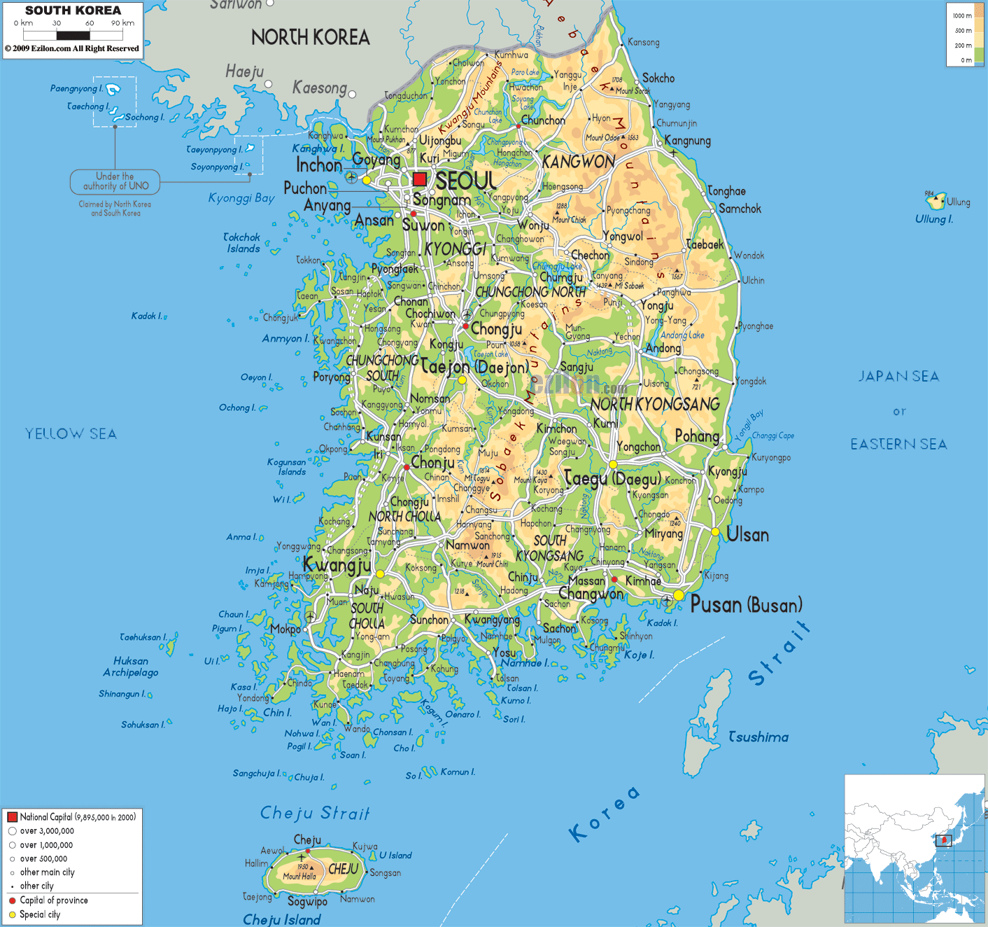

Description: The Physical Map of South Korea showing major geographical features like elevations, mountain ranges, ocean, seas, lakes, plateaus, peninsulas, rivers, plains, landforms and other topographic features.
 The
Korean Peninsula’s southern part is known as South Korea
which is officially called the Republic of Korea. It is
a country in East Asia. North Korea is the only country
with which it shares land border. Apart it has maritime
boundaries with Japan and China. It runs 1,100
kilometres from the mainland. To the west it has Yellow
Sea and to the east it has Sea of Japan. The
southernmost tip of the country reaches to the Korean
Strait and the East China Sea. 100,032 square kilometres
is the total area of this country.
The topography of the country mostly features mountains
which are not arable. Only thirty percent of the area
has lowlands. Jeju-do is the largest island among other
numbering almost three thousand. With an area of 1,845
square kilometres it contains Hallasan at 1,950 meters,
an extinct volcano and the country’s highest point.

Political Map of South Korea
Political map and map image of South Korea.

Road Map of South Korea
Road map and map image of South Korea.

Regional Directory of United States of America
Information and guide about United States of America and websites with American topics.

Regional Directory of Europe
Information and guide about Europe and websites with European topics.

Regional Directory of Australia
Information and guide about Australia and websites with Australian topics.