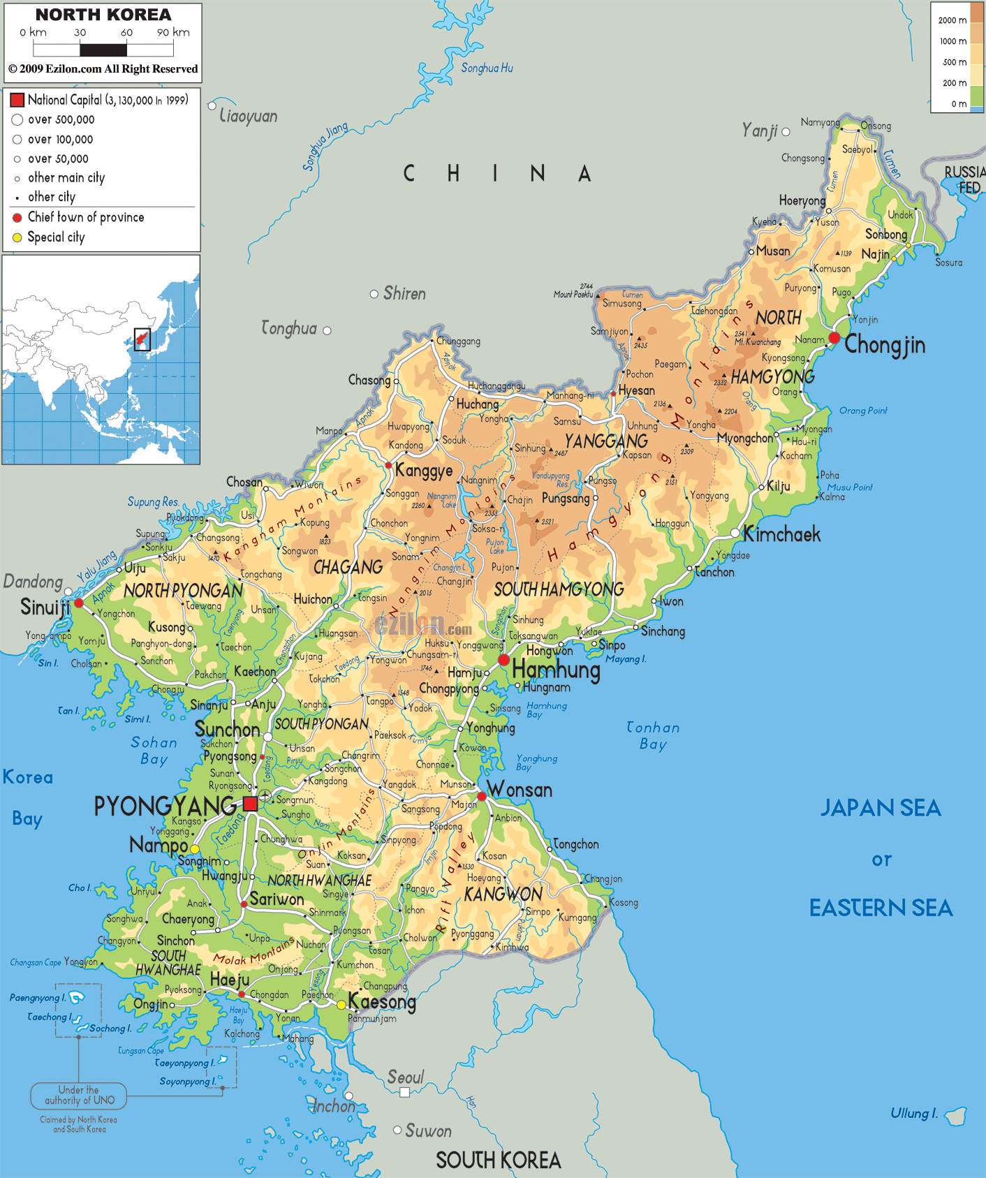

Description: The Physical Map of North Korea showing major geographical features like elevations, mountain ranges, deserts, ocean, seas, lakes, plateaus, peninsulas, rivers, plains, landforms and other topographic features.
 With
the official name as the Democratic People's Republic of
Korea, North Korea is a country in East Asia. It is
situated in the Korean Peninsula’s north part. To the
north and north-west it shares land border with China.
To the northeast, it has a border with Russia along the
banks of river Tumen.
The Korean Demilitarized Zone separates North Korea from
South Korea. Korean Bay and Yellow Sea lies to the west
of North Korea. To its east across Japan Sea lies the
Japan.
Baekdu Mountain is the highest point of North Korea and
it is a volcanic mountain. Basalt lava plateau having
elevation ranging between 1,400 and 2,744 meters
separates the country from China. Kwanmobong in the
Hamgyong Range having a height of approximately 2,541
metres is the highest peak in northeast part. Mount
Kumgang is known for its beautiful scenery.

Political Map of North Korea
Political map and map image of North Korea.

Road Map of North Korea
Road map and map image of North Korea.

Regional Directory of United States of America
Information and guide about United States of America and websites with American topics.

Regional Directory of Europe
Information and guide about Europe and websites with European topics.

Regional Directory of Australia
Information and guide about Australia and websites with Australian topics.