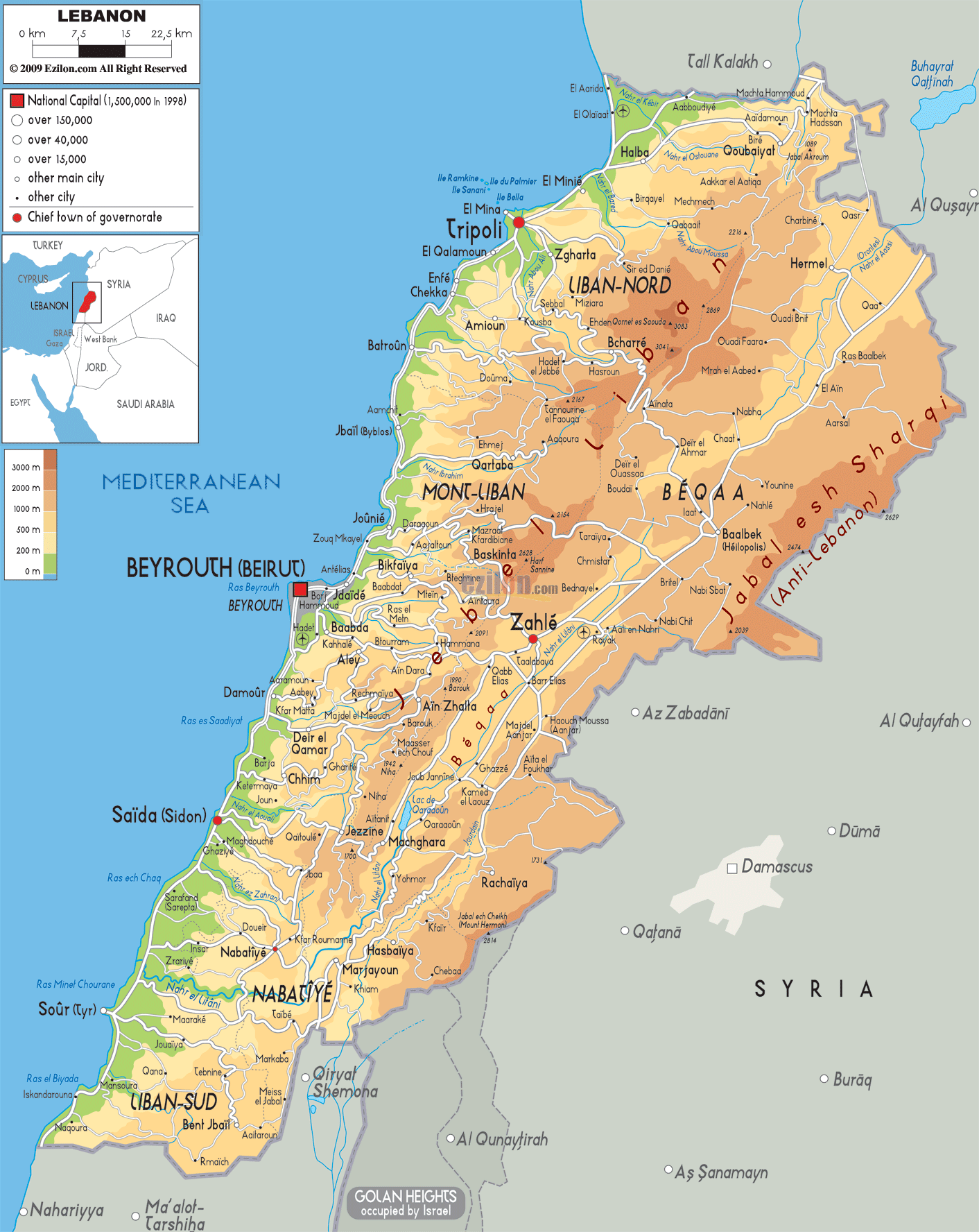

Description: The Physical Map of Lebanon showing major geographical features like elevations, mountain ranges, deserts, seas, lakes, plateaus, peninsulas, rivers, plains, landforms and other topographic features.
 Lebanon
is officially known as the Lebanese Republic. It is a
country in Western Asia and shares its borders with
Syria on the north and east and with Israel on the
south. Lebanon's is located at the crossroads of the
Mediterranean Basin.
The country's surface area is about 10,500 square
kilometres of which 10,230 square kilometres is only
land. Lebanon has a coastline and border of 225
kilometres on the Mediterranean Sea to the west, a 375
kilometres border shared with Syria to the north and
east and a 79 kilometres long border with Israel to the
south.
The Lebanon Mountains rise steeply parallel to the
Mediterranean coast and form a ridge of limestone and
sandstone that runs for most of the country's length.
The Lebanon mountains peak at 3,088 metres above sea
level in Qurnat as Sawda' in North Lebanon and gradually
slope to the south before rising again to a height of
2,695 metres in Mount Sannine.

Political Map of Lebanon
Political map and map image of Lebanon.

Road Map of Lebanon
Road map and map image of Lebanon.

Regional Directory of United States of America
Information and guide about United States of America and websites with American topics.

Regional Directory of Europe
Information and guide about Europe and websites with European topics.

Regional Directory of Australia
Information and guide about Australia and websites with Australian topics.