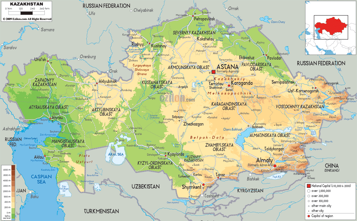

Description: The Physical Map of Kazakhstan showing major geographical features like elevations, mountain ranges, deserts, seas, lakes, plateaus, peninsulas, rivers, plains, landforms and other topographic features.
 Officially
known as the Republic of Kazakhstan, the country of
Kazakhstan is located in central Asia and some part of
it situated on the western side of the European’s Ural
River. Largest landlocked country of the world is
Kazakhstan and it comes at number nine in world ranking
in terms of area. 2,727,300 square kilometres is the
total area of Kazakhstan.
In size Kazakhstan is equivalent to western Europe. The
following countries have the borders with Kazakhstan-
China, Russia, Kyrgyzstan, Turkmenistan, Uzbekistan and
also with Caspian Sea. Kazakhstan’s topography includes
hills, deserts, deltas, taiga , flatlands, steppe, rock
canyons and snow covered mountains.
Large marshlands and sandy areas are the characteristic
of steppe. Aral Sea is the major sea. The main lakes are
Lake Zaysan and Lake Balkhash. The rivers of importance
are Irtysh, lli, Ishim, Ural, Charyn River and Syr
Darya.

Political Map of Kazakhstan
Political map and map image of Kazakhstan.

Road Map of Kazakhstan
Road map and map image of Kazakhstan.

Regional Directory of United States of America
Information and guide about United States of America and websites with American topics.

Regional Directory of Europe
Information and guide about Europe and websites with European topics.

Regional Directory of Australia
Information and guide about Australia and websites with Australian topics.