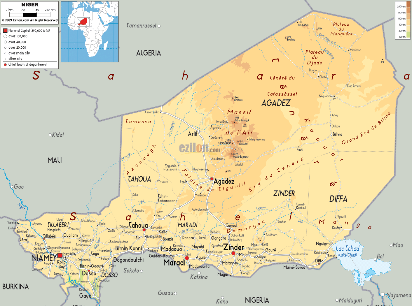

Description: The Physical Map of Niger showing major geographical features like elevations, mountain ranges, deserts, lakes, plateaus, peninsulas, rivers, plains, landforms and other topographic features.
 Niger
is a country that has been named after the River Niger
and it is a landlocked nation in the western Africa. It
is considered to be the largest nation in West Africa
and it has an area of about 1,270,000 square kilometers.
Niger is a country with about 13,300,000 and most of
them live in west and south of the country. Niamey is
its capital city. About 4/5th of the nation is covered
by desert and it is also considered to be one of the
poorest countries in the world. The country is
susceptible to periodic desertification and drought.
Niger
is a country that has been named after the River Niger
and it is a landlocked nation in the western Africa. It
is considered to be the largest nation in West Africa
and it has an area of about 1,270,000 square kilometers.
Niger is a country with about 13,300,000 and most of
them live in west and south of the country. Niamey is
its capital city. About 4/5th of the nation is covered
by desert and it is also considered to be one of the
poorest countries in the world. The country is
susceptible to periodic desertification and drought.
The people from Niger are called Nigeriens.

Political Map of Niger
Political map and map image of Niger.

Road Map of Niger
Road map and map image of Niger.

Regional Directory of United States of America
Information and guide about United States of America and websites with American topics.

Regional Directory of Europe
Information and guide about Europe and websites with European topics.

Regional Directory of Australia
Information and guide about Australia and websites with Australian topics.