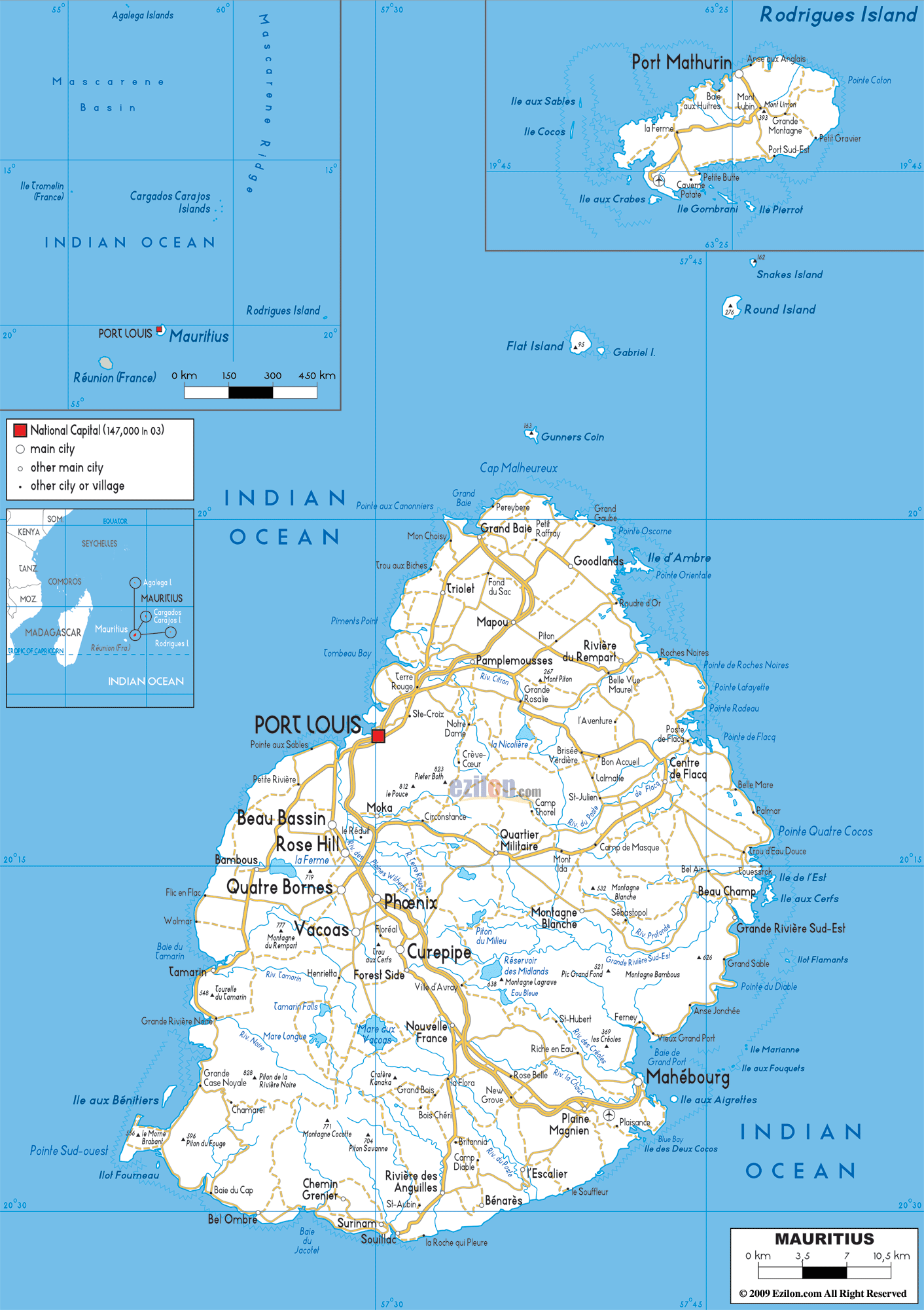

Description: Detailed clear large road map of Mauritius with road routes from cities to towns, road intersections to provinces and perfectures.
 Mauritius
is an island nation that is located off the coast of the
African continent. It is situated about nine hundred
kilometers east of Madagascar. This nation was
discovered by the Portuguese in the year 1505 and it
attained independence in the year 1968 after being under
the rule of the Portuguese, British, French and Dutch.
It is a beautiful country that is also a famous tourist
destination in the world. The beaches are simply
beautiful and they are lined with casuarinas and palm
trees. It is the only known home of the dodo.
The people from Mauritius are called Mauritians.

Physical Map of Mauritius
Physical map and map image of Mauritius.

Political Map of Mauritius
Political map and map image of Mauritius.

Regional Directory of United States of America
Information and guide about United States of America and websites with American topics.

Regional Directory of Europe
Information and guide about Europe and websites with European topics.

Regional Directory of Australia
Information and guide about Australia and websites with Australian topics.