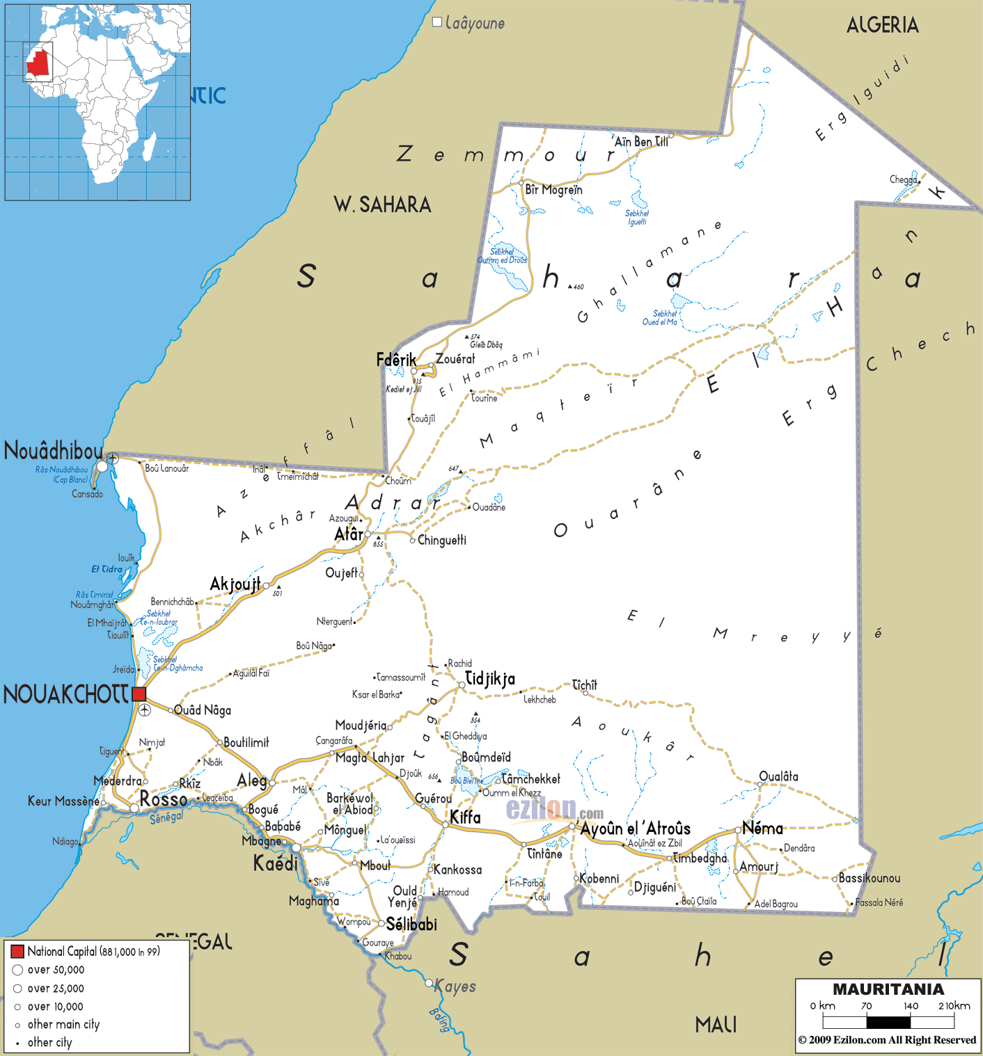

Description: Detailed clear large road map of Mauritania with road routes from cities to towns, road intersections to provinces and perfectures.
 Located
in the northwest of Africa, Mauritania is also referred
to as the Islamic Republic of Mauritania. On the west of
this country is the Atlantic Ocean and on its east is
Mali. Nouakchott is not just the largest city in the
county but it is also the capital city of Mauritania.
The nation is considered to be the twenty-ninth largest
nation in the world with a land area of 397,929 square
miles. The size of the country is more or less like the
size of Egypt. About 3/4th of the country is either
semi-desert or desert.
The people from Mauritania are called Mauritanians.

Physical Map of Mauritania
Physical map and map image of Mauritania.

Political Map of Mauritania
Political map and map image of Mauritania.

Regional Directory of United States of America
Information and guide about United States of America and websites with American topics.

Regional Directory of Europe
Information and guide about Europe and websites with European topics.

Regional Directory of Australia
Information and guide about Australia and websites with Australian topics.