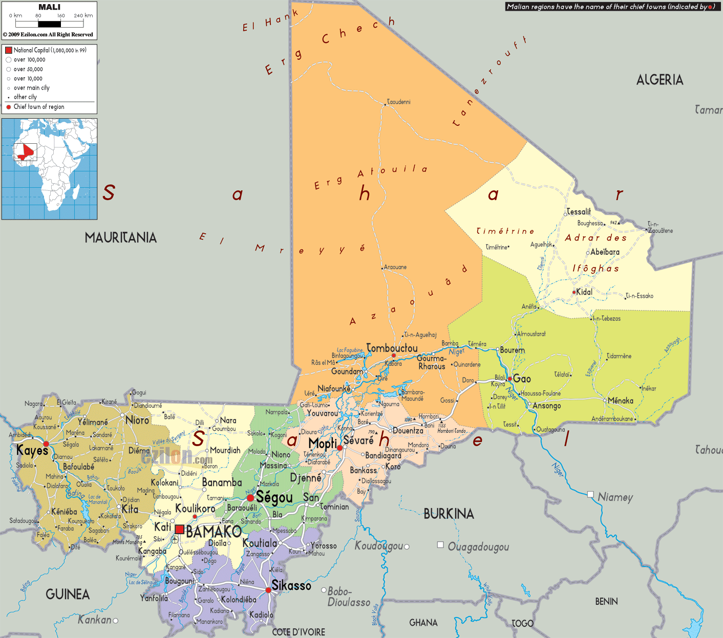
Description: Detailed large political map of Mali showing names of capital cities, towns, states, provinces and boundaries with neighbouring countries.
 Mali
is also known as the Republic of Mali. This landlocked
country is situated in western Africa and it is the
seventh largest country in this continent. It has the
Côte d'Ivoire and Burkina Faso on its south, Algeria on
its north and Mauritania and Senegal on its west. Bamako
is the capital city of Mali and it has about 12,000,000
people in its land. Fishing and agriculture are the two
main industries where most of the country's revenue
comes from. Salt, uranium and gold are some of the
natural resources of this nation. Mali may be the
twenty-fourth largest country in the world, but it is
also one of the poorest countries worldwide. The yearly
salary of an average worker is about US$1,500, which is
very less. The size of this nation is similar to the
size of Peru or South Africa.
Mali
is also known as the Republic of Mali. This landlocked
country is situated in western Africa and it is the
seventh largest country in this continent. It has the
Côte d'Ivoire and Burkina Faso on its south, Algeria on
its north and Mauritania and Senegal on its west. Bamako
is the capital city of Mali and it has about 12,000,000
people in its land. Fishing and agriculture are the two
main industries where most of the country's revenue
comes from. Salt, uranium and gold are some of the
natural resources of this nation. Mali may be the
twenty-fourth largest country in the world, but it is
also one of the poorest countries worldwide. The yearly
salary of an average worker is about US$1,500, which is
very less. The size of this nation is similar to the
size of Peru or South Africa.
The people from Mali are called Malians.

Physical Map of Mali
Physical map and map image of Mali.

Road Map of Mali
Road map and map image of Mali.

Regional Directory of United States of America
Information and guide about United States of America and websites with American topics.

Regional Directory of Europe
Information and guide about Europe and websites with European topics.

Regional Directory of Australia
Information and guide about Australia and websites with Australian topics.