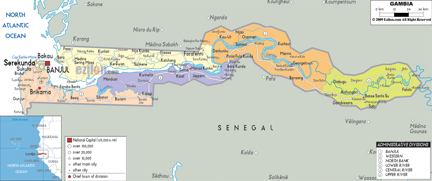

Description: Detailed large political map of Gambia showing names of capital cities, towns, states, provinces and boundaries of neighbouring countries.
 Situated
in West Africa with Banjul as its capital, Gambia is the
smallest African inland country. Its border touches
Senegal and the coastal area looks over the Atlantic
Ocean. The Gambian population speaks English as an
official language, although the local languages such as
Fula and Jola, amongst others are widely spoken.
Although Gambia is a mere strip of land it offers a diversified landscape, with lush tropical forests, swamps, marshes, wooded savannah and sandy beaches, the River Gambia running right through the country. Gambia is also a paradise for birdwatchers with over 540 different species to spot. The national parks and reserves are a major asset, attracting an ecotourism to its pristine landscapes.
The people from Gambia are called Gambians.

Physical Map of Gambia
Physical map and map image of Gambia.

Road Map of Gambia
Road map and map image of Gambia.

Regional Directory of United States of America
Information and guide about United States of America and websites with American topics.

Regional Directory of Europe
Information and guide about Europe and websites with European topics.

Regional Directory of Australia
Information and guide about Australia and websites with Australian topics.