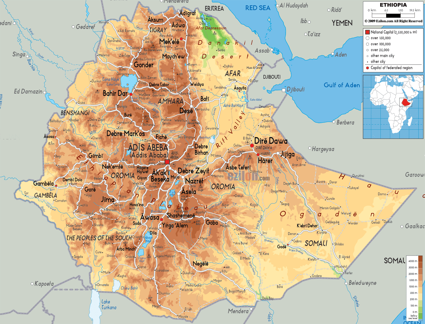

Description: The Physical Map of Ethiopia showing major geographical features like elevations, mountain ranges, deserts, seas, lakes, plateaus, peninsulas, rivers, plains, landforms and other topographic features.
 Ethiopia
is one of the many countries which are located in the
Horn of Africa. The country lies between 9 degrees north
latitude and 38.7 degrees east longitude. The total area
taken up by the country is 1127127 square kilometers of
which 1119683 square kilometers is land and 7444 square
kilometers is occupied by the water bodies. The country
shares no coastlines as it is a landlocked country.
The Ethiopian highlands exist near the country’s border
to the east and it contains steep rising plateaus. The
plateau is cut across by the Awash River which also
crosses the Ahmar Mountain Range. Most of the country is
sloped from the north to the west and that is where most
of the rivers flow. The rivers of Ethiopia make up for
85% of the water present in the River Nile. The three
main rivers are the Tekeze up north, Sobat down south
and Abay right in the center.

Political Map of Ethiopia
Political map and map image of Ethiopia.

Road Map of Ethiopia
Road map and map image of Ethiopia.

Regional Directory of United States of America
Information and guide about United States of America and websites with American topics.

Regional Directory of Europe
Information and guide about Europe and websites with European topics.

Regional Directory of Australia
Information and guide about Australia and websites with Australian topics.