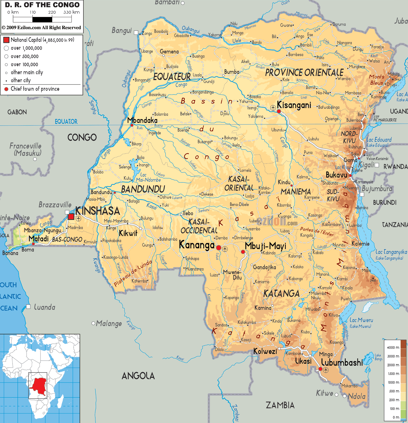
Description: The Physical Map of Democratic Republic of Congo showing major geographical features like elevations, mountain ranges, deserts, lakes, plateaus, peninsulas, rivers, plains, landforms and other topographic features.
 The
democratic Republic of Congo is a country which lies
near the Congo River Basin. The basin covers a massive
area of over 1000000 square kilometers. The country sits
on the equator which takes temperatures sky high. But
the Ruwenzori Mountain Range in the south brings things
under control. The rainy seasons both north and south of
the equator are fairly regular and this provides the
country with 1070 millimeters of rain every year.
The
democratic Republic of Congo is a country which lies
near the Congo River Basin. The basin covers a massive
area of over 1000000 square kilometers. The country sits
on the equator which takes temperatures sky high. But
the Ruwenzori Mountain Range in the south brings things
under control. The rainy seasons both north and south of
the equator are fairly regular and this provides the
country with 1070 millimeters of rain every year.
The west frontiers are marked by long mountain ranges
and the south and south west are covered by the vast
savanna plains. The north has huge low lying grasslands
and the Ruwenzori Range takes up the east. The highest
point in the country is called Pic Marguerite which is a
part of Mont Ngaliema and is 5110 meters above sea
level. The lowest part of the country rests at sea
level.

Political Map of Democratic Republic of Congo
Political map and map image of Democratic Republic of Congo.

Road Map of Democratic Republic of Congo
Road map and map image of Democratic Republic of Congo.

Regional Directory of United States of America
Information and guide about United States of America and websites with American topics.

Regional Directory of Europe
Information and guide about Europe and websites with European topics.

Regional Directory of Australia
Information and guide about Australia and websites with Australian topics.