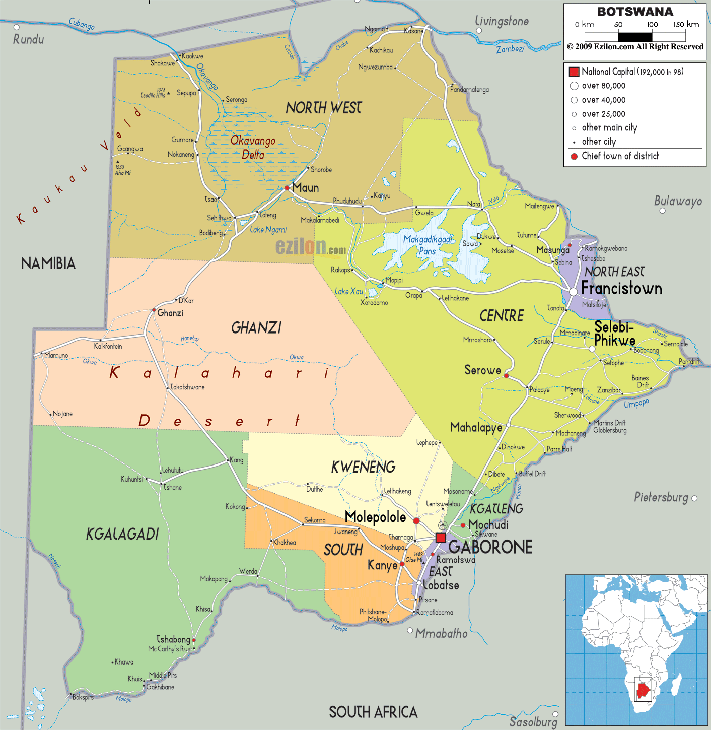

Description: Detailed large political map of Botswana showing names of capital cities, towns, states, provinces and boundaries of neighbouring countries.
 Botswana
is situated in central southern Africa, landlocked
between Zimbabwe, South Africa, Namibia and Zambia. To
the south and center, the Kalahari Desert covers most of
the land, while to the northwest lies the Okavango
Delta, the pearl of Botswana. This is the largest inland
delta in the world, connected by waterways and scattered
with islands and lagoons, populated by many rare animal
species.
The people from Botswana are called Batswana.

Physical Map of Botswana
Physical map and map image of Botswana.

Road Map of Botswana
Road map and map image of Botswana.

Regional Directory of United States of America
Information and guide about United States of America and websites with American topics.

Regional Directory of Europe
Information and guide about Europe and websites with European topics.

Regional Directory of Australia
Information and guide about Australia and websites with Australian topics.